Have you ever wondered what life was like on your city’s streets centuries ago? How the hustle and bustle, the people, and the architecture have evolved over time? Well, I recently embarked on a fascinating journey, exploring the depths of Toronto’s rich history by delving into the treasure trove that is the Toronto Archives’ photo collection.
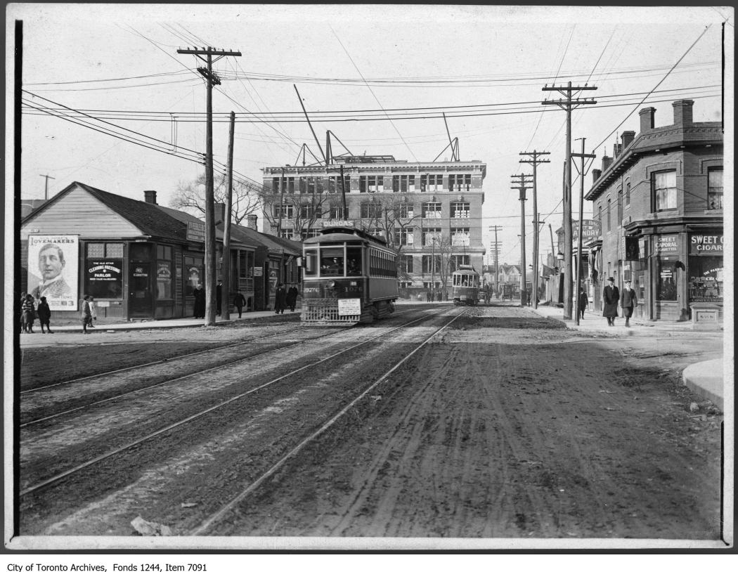
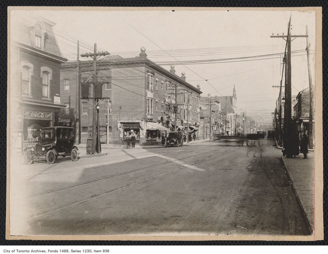
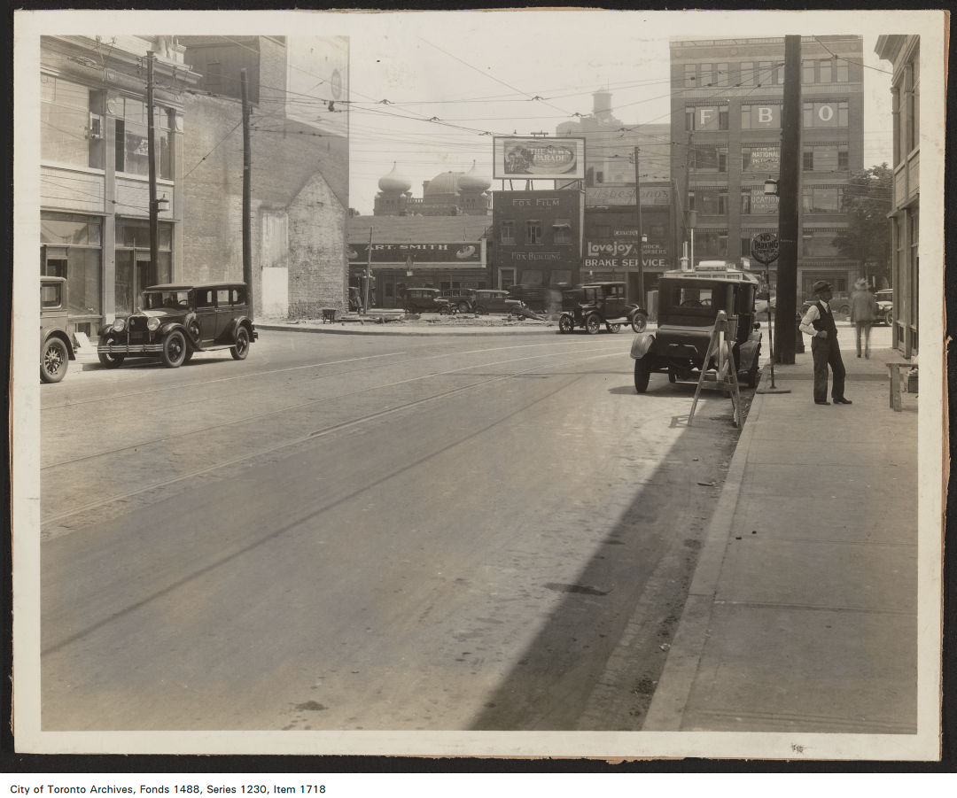
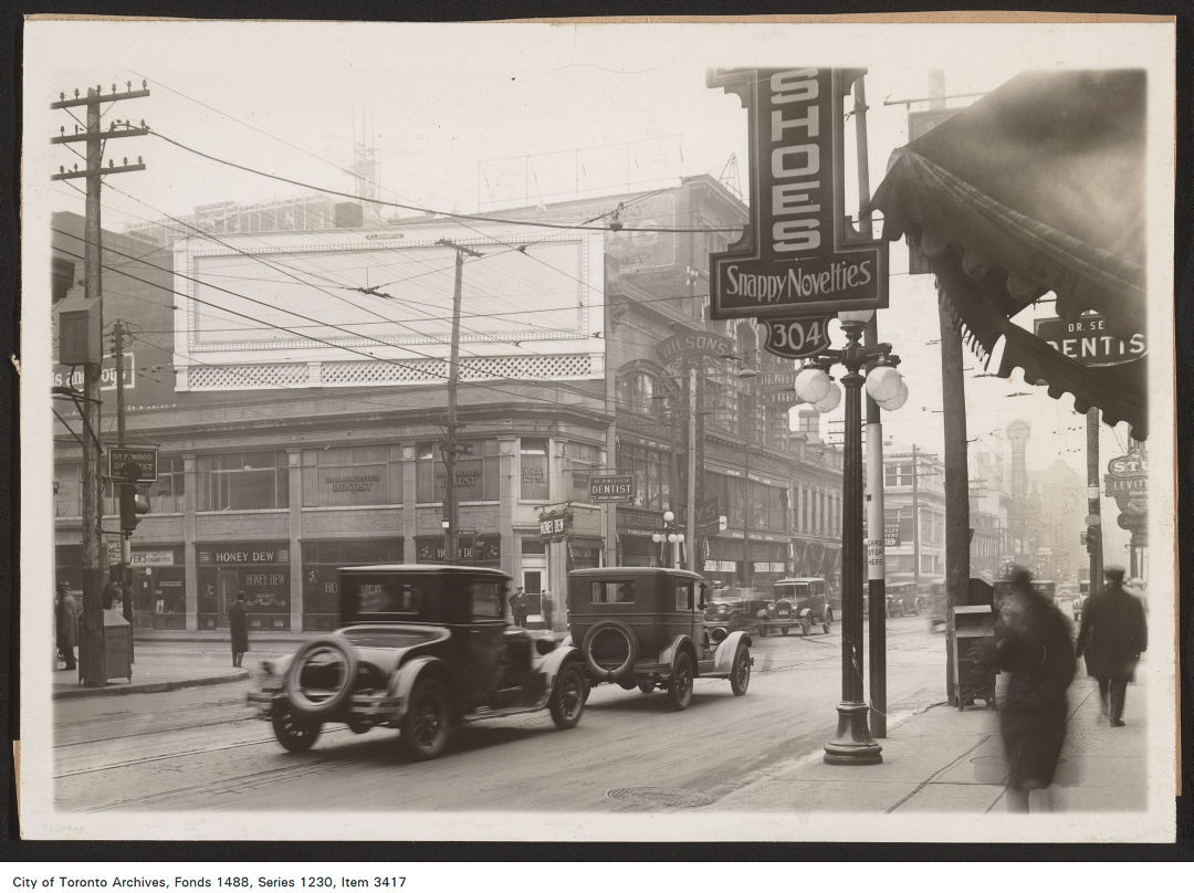
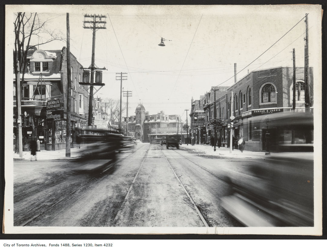
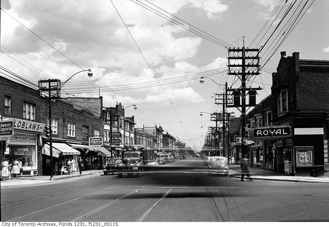
1900 – 1930 – Looking West on Dundas Street from Centre Avenue to University Avenue
During my virtual expedition, I stumbled upon an exquisite gallery of images featuring Dundas Street, one of Toronto’s most iconic and historically significant thoroughfares, captured between the years 1900 through to the 1980s. This delightful discovery now offers us a precious glimpse into the past, allowing us to travel back in time and witness the transformation of this vibrant street through the decades.
The Toronto Archives houses an incredible collection of photographs, documents, and records that paint an intricate picture of our city’s heritage. Not only are these images available to browse, but they can also be purchased, giving us the opportunity to own a piece of Toronto’s past and embrace our connection to the generations before us.
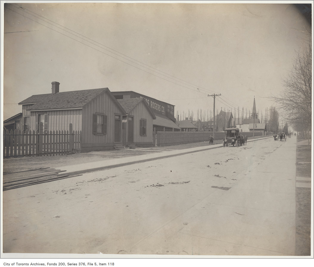
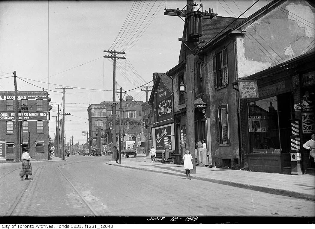
1907 – Lansdowne Avenue, looking north to Dundas Street
There’s something undeniably captivating about gazing at old photographs from your city. It’s like peering through a mystical window, where time dissolves, and the stories of those who came before us come alive. Scrolling through snapshots of Dundas Street’s evolution, you’ll witness the humble beginnings of horse-drawn carriages and bustling marketplaces, the birth of the electric streetcar system, and the eventual emergence of the modern metropolis we now call home.
So, what’s the story behind Dundas Street, you may wonder? Named after Lieutenant Governor John Graves Simcoe’s friend, Henry Dundas, 1st Viscount Melville, this iconic street has played an integral role in shaping Toronto’s identity. Stretching across the city and commanding a prominent place in its history, Dundas Street stands as a testament to our collective heritage and the ever-changing landscape that has molded our city into what it is today.
Join me on this immersive journey as we explore the photographs and memories of Dundas Street held within the Toronto Archives. Prepare to be transported through time, to a place where history intertwines with the present, and the past whispers its secrets, waiting to be rediscovered by those curious enough to listen.
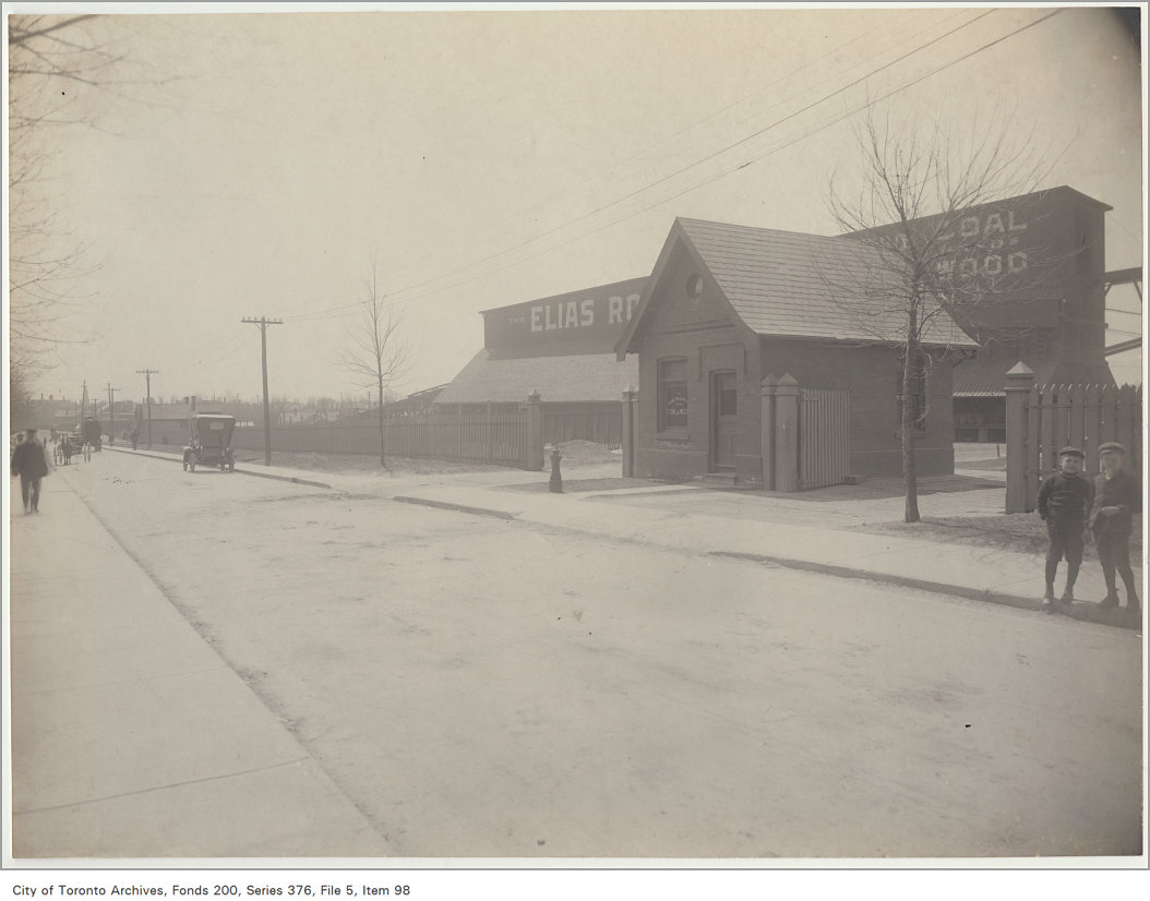
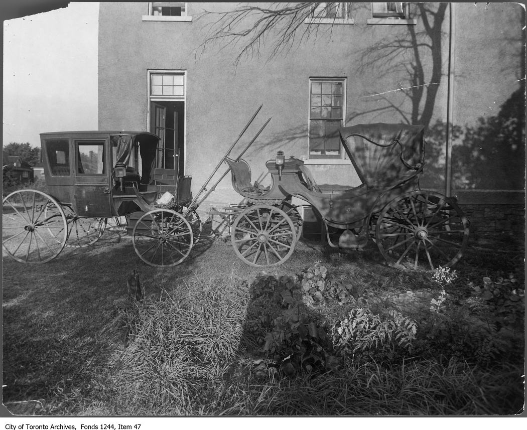
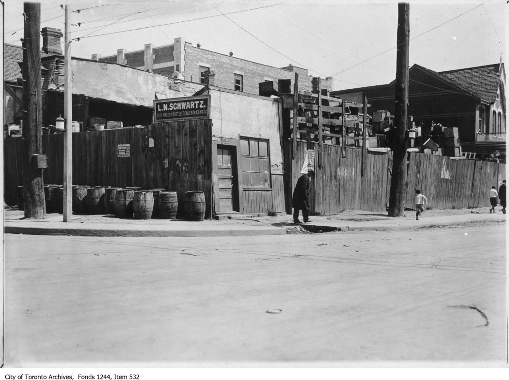
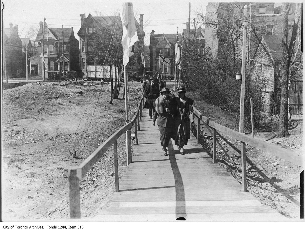
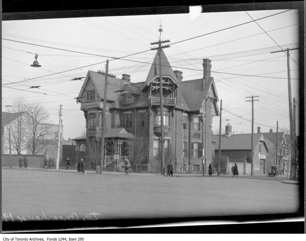
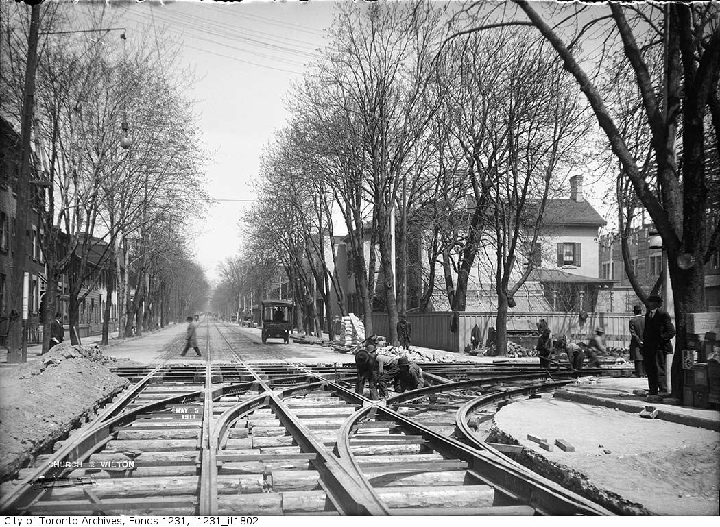
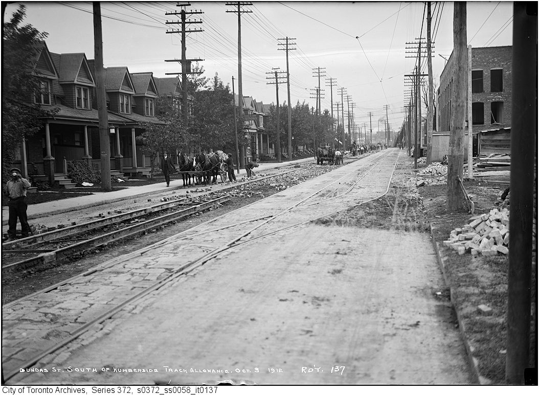
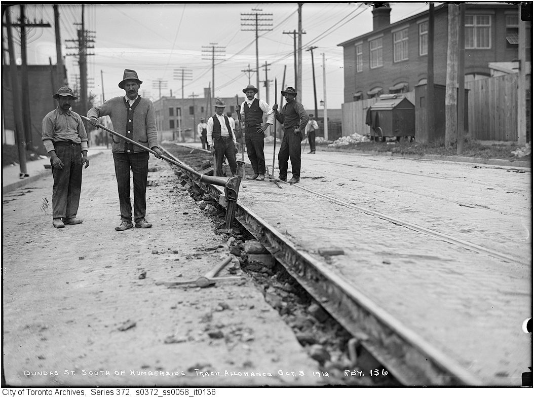
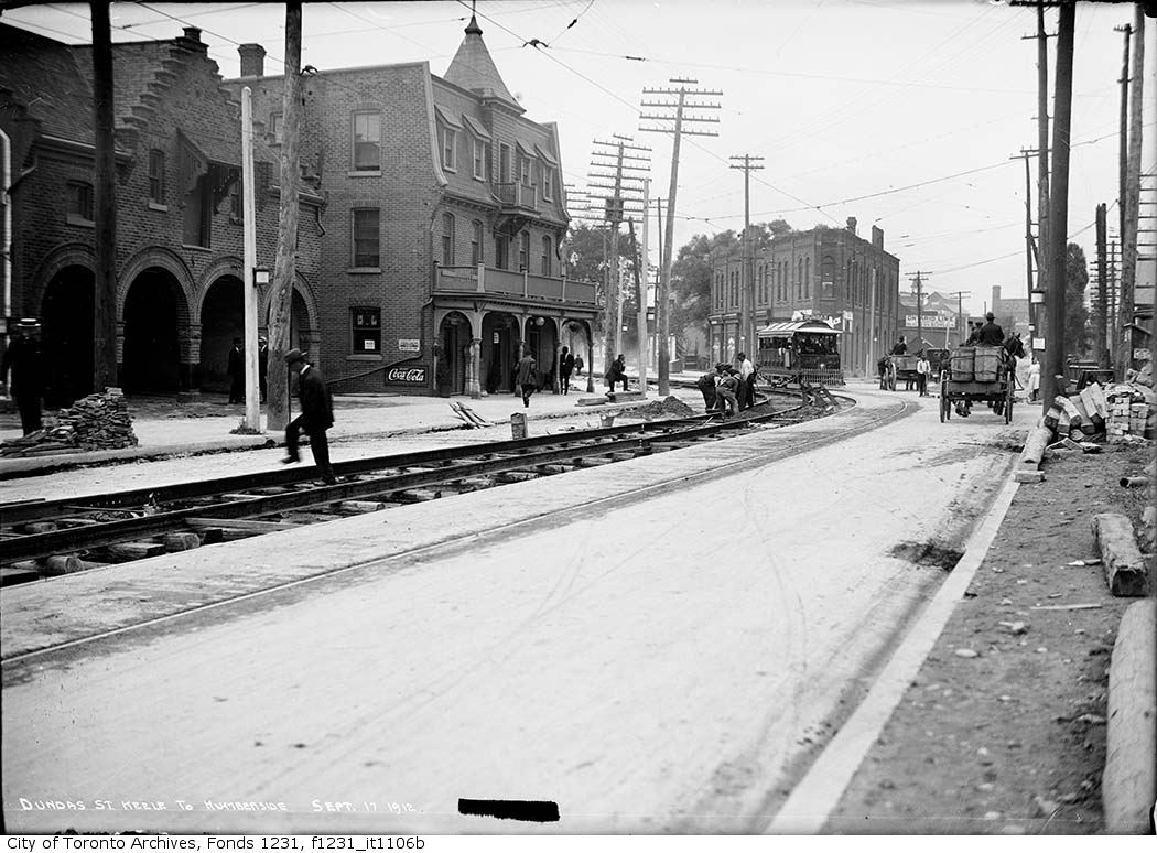
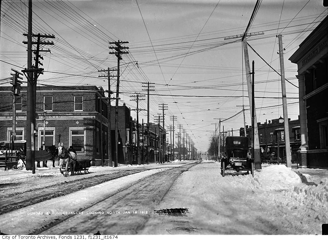
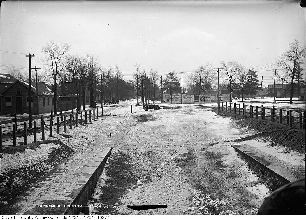
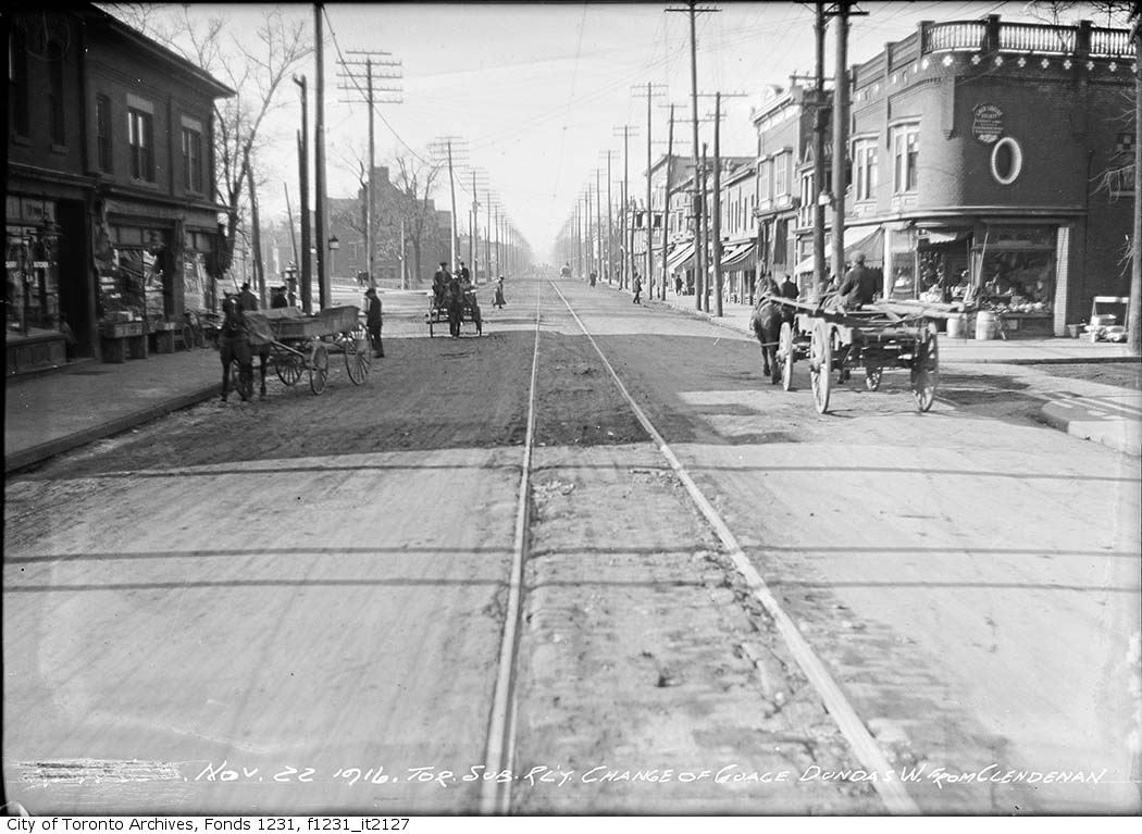
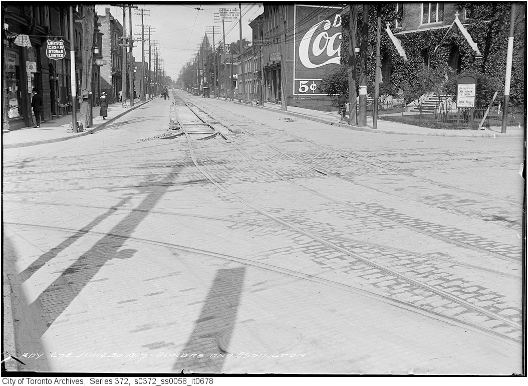
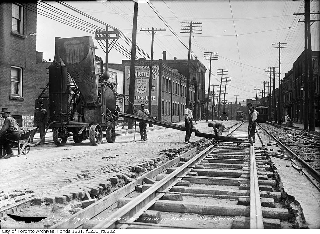
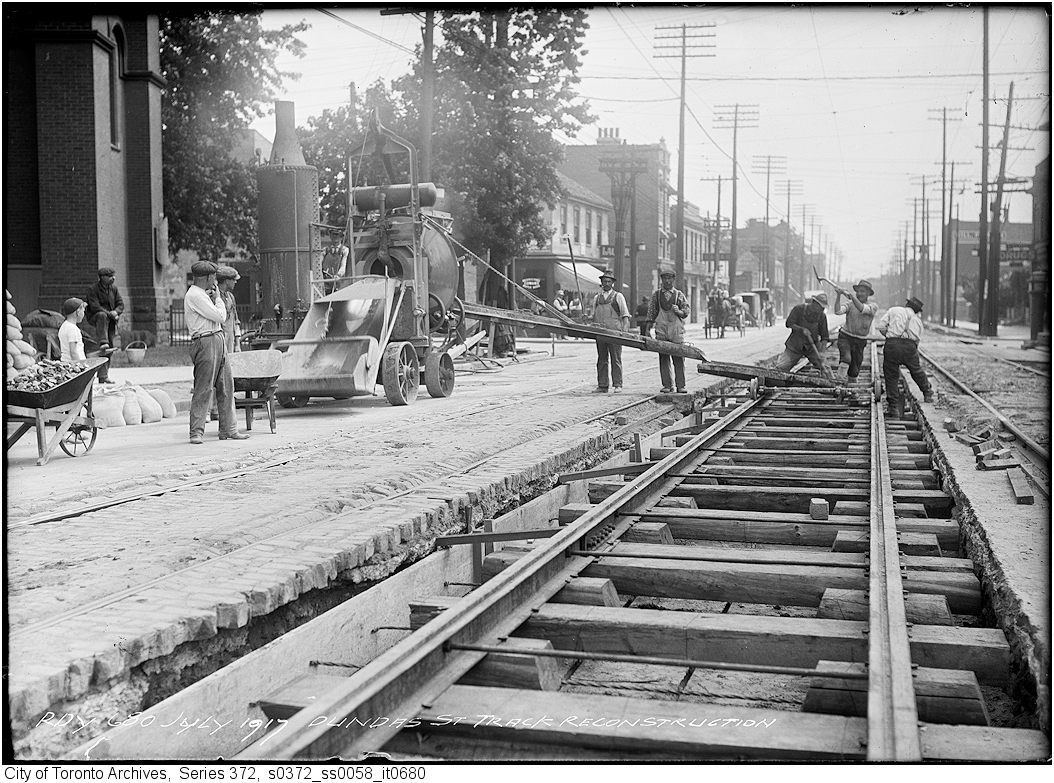
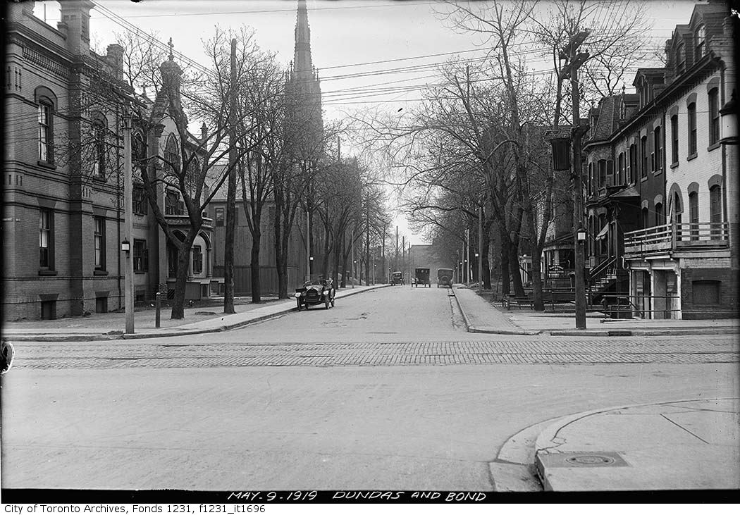
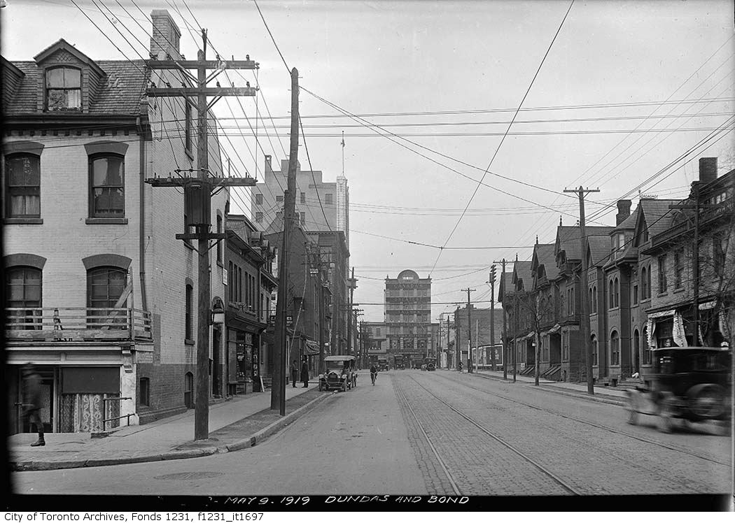
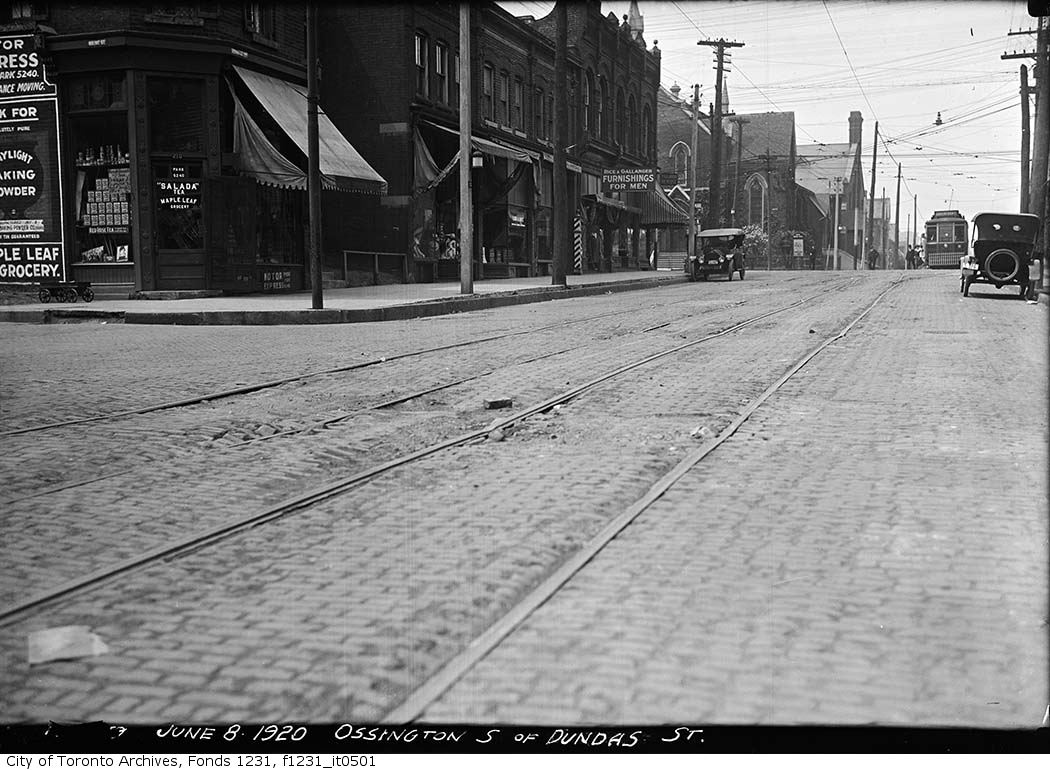
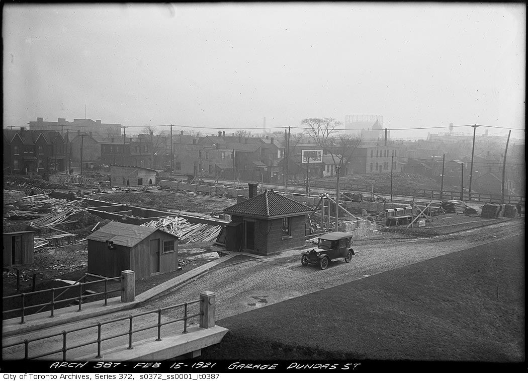
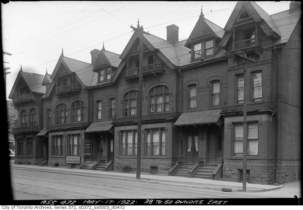
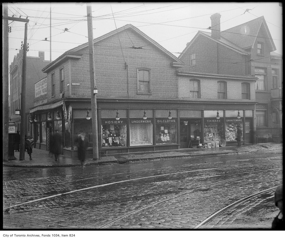
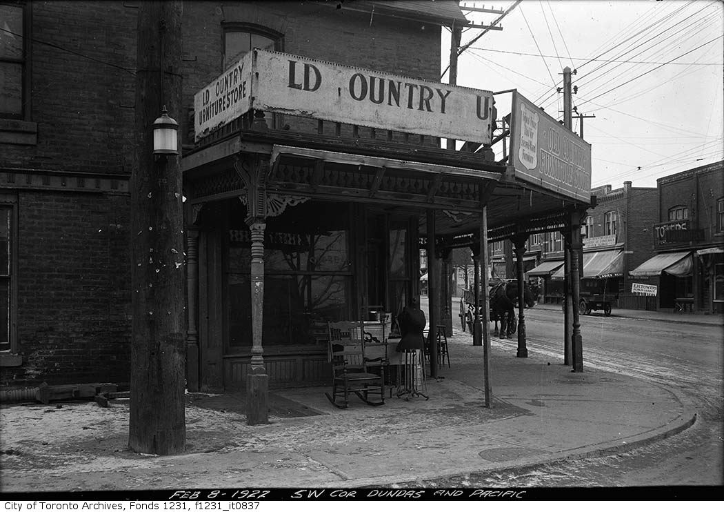
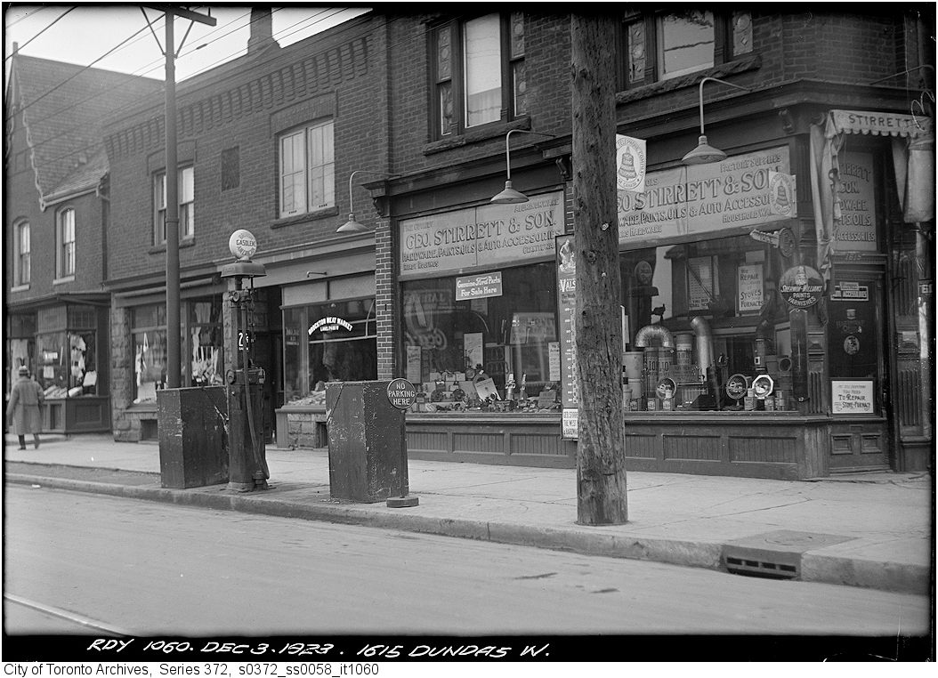
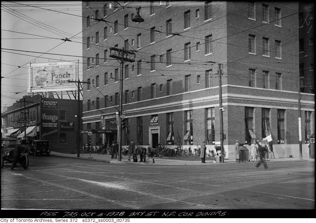
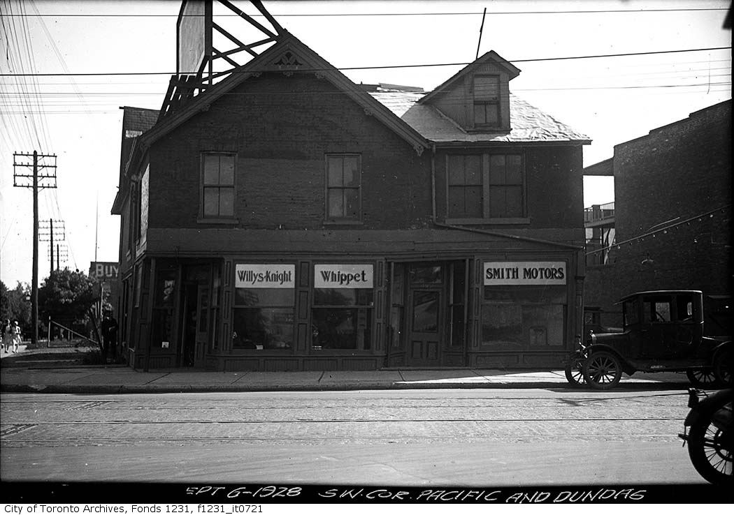
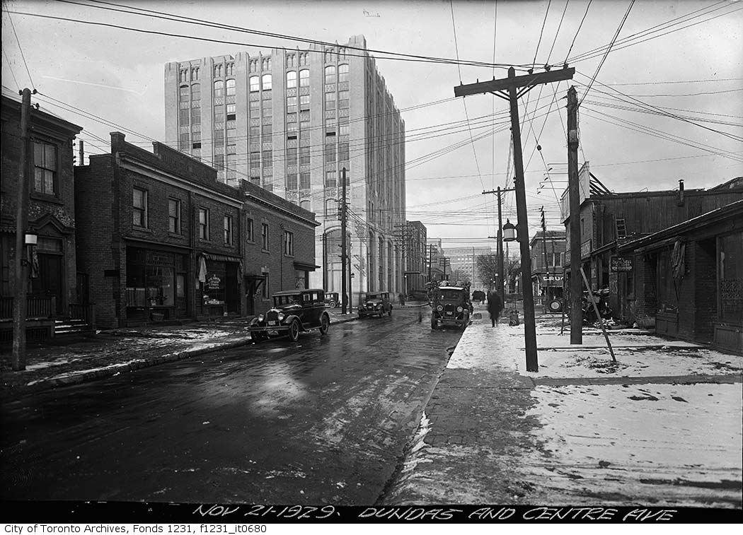
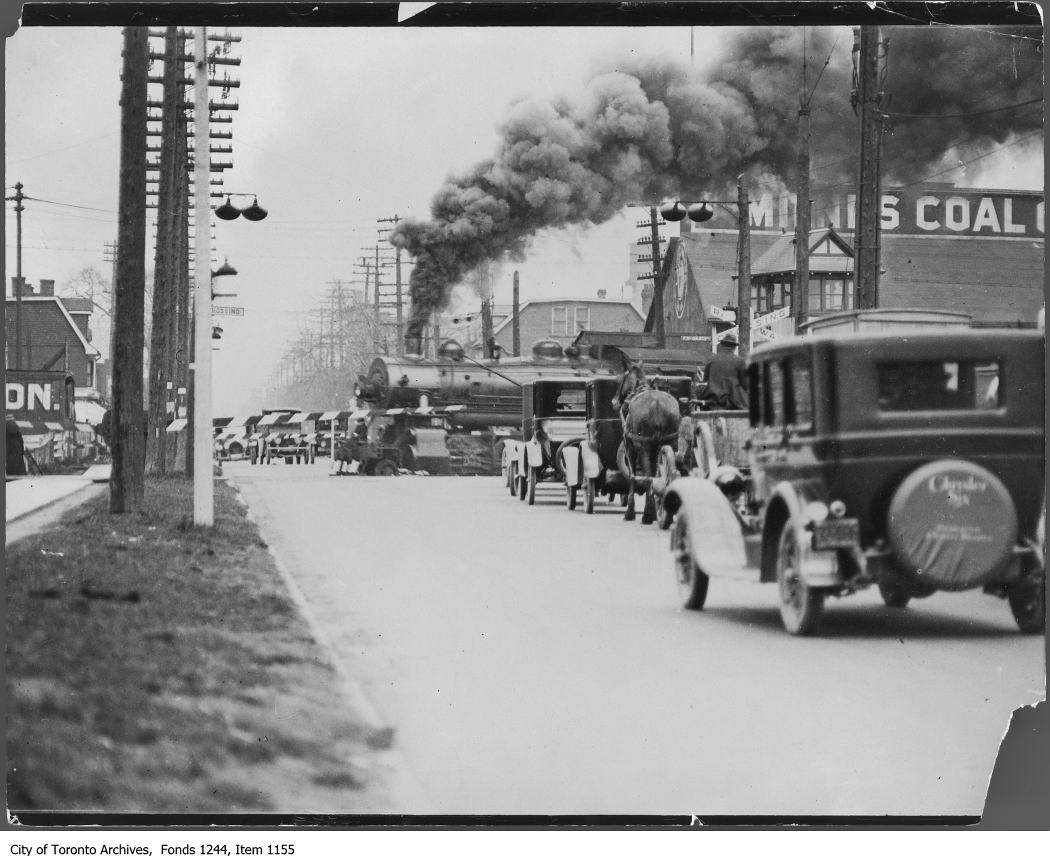
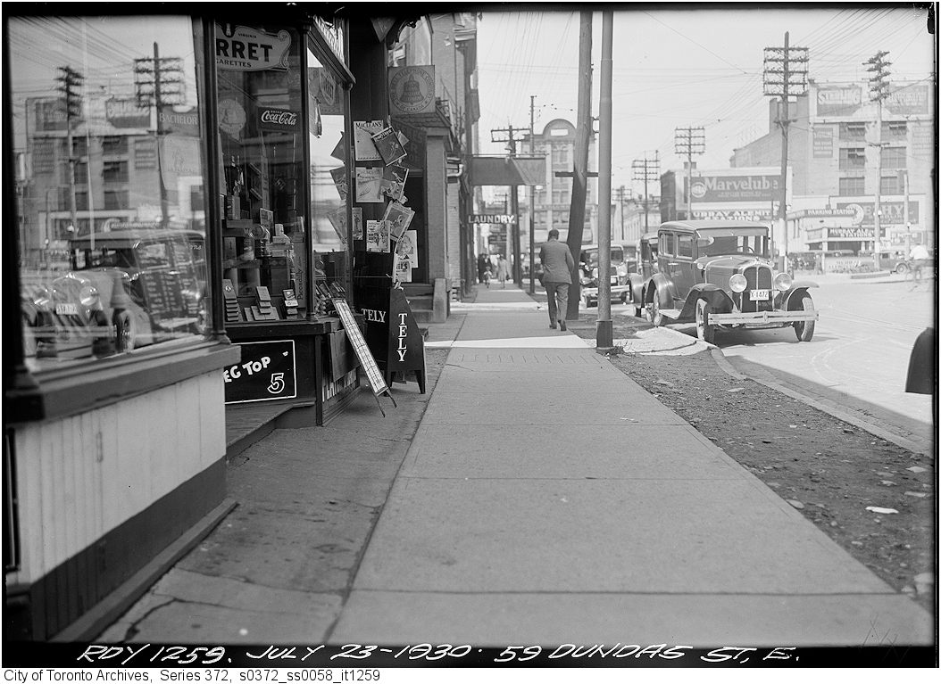
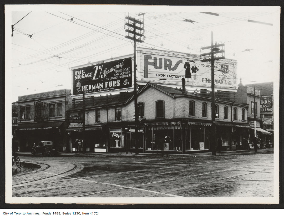
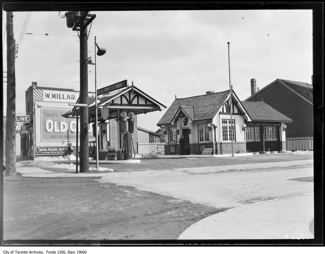
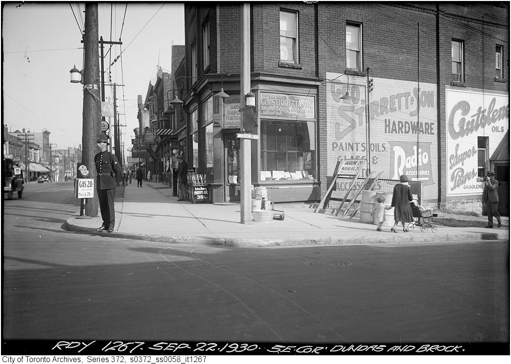
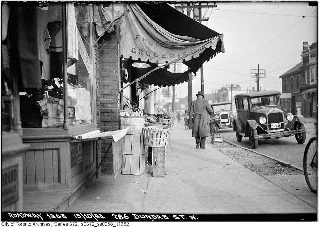
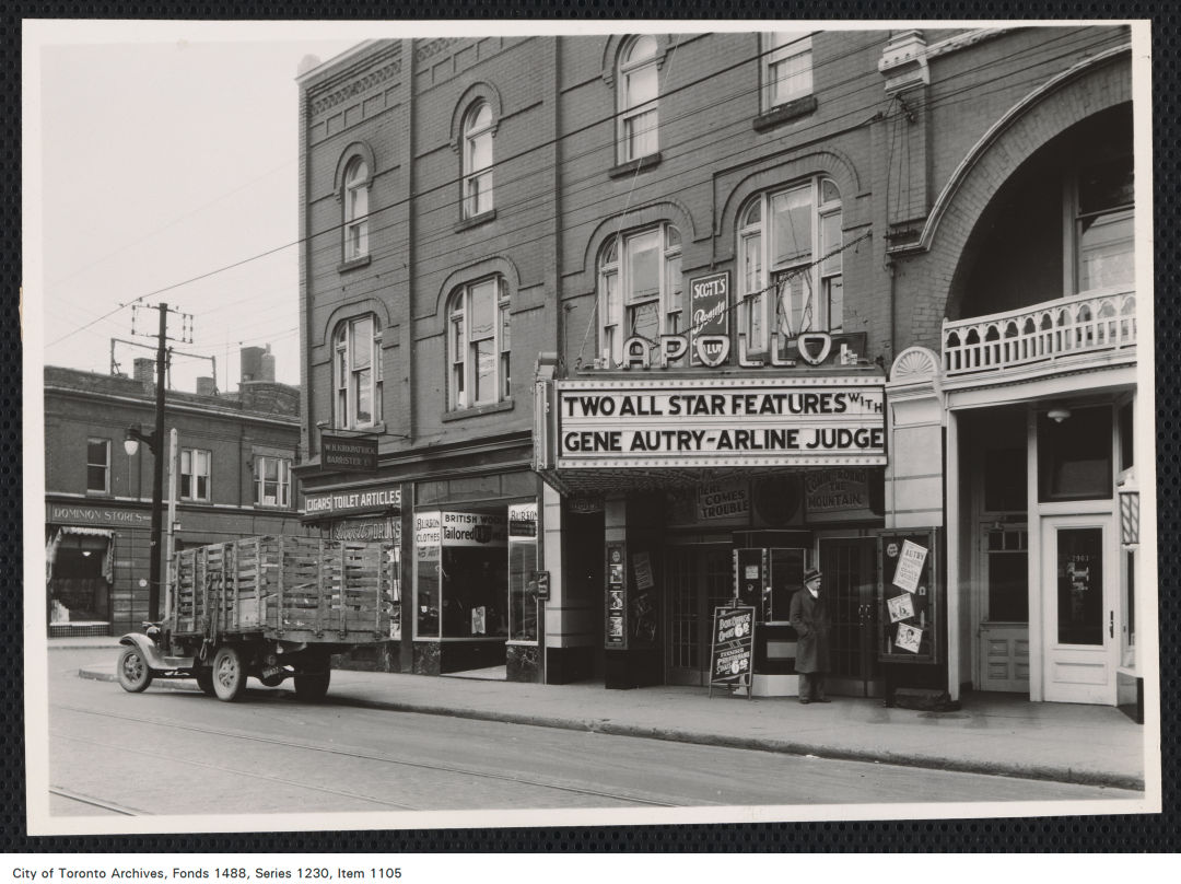
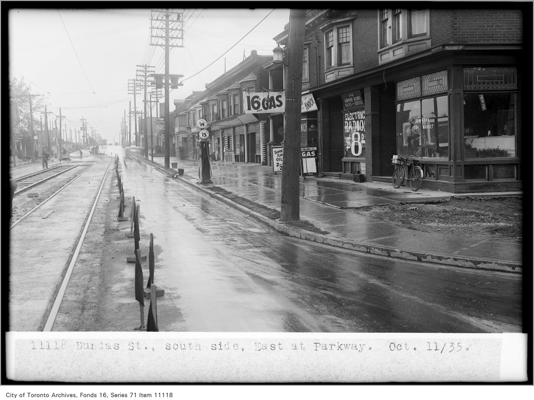
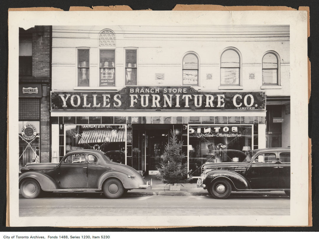
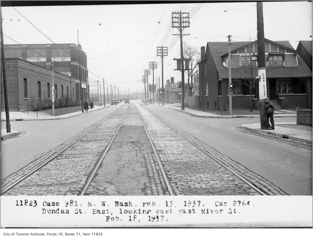
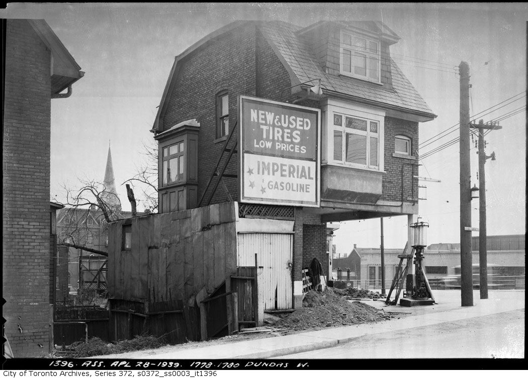
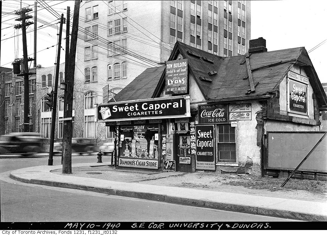
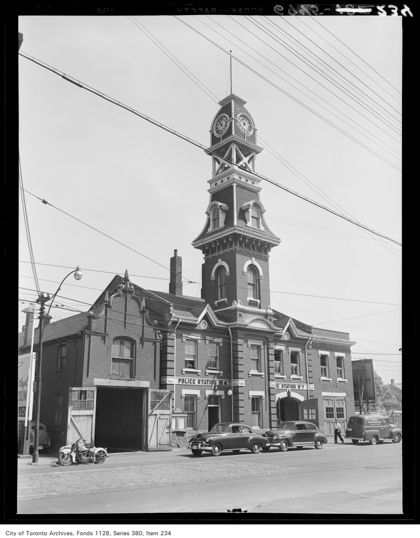
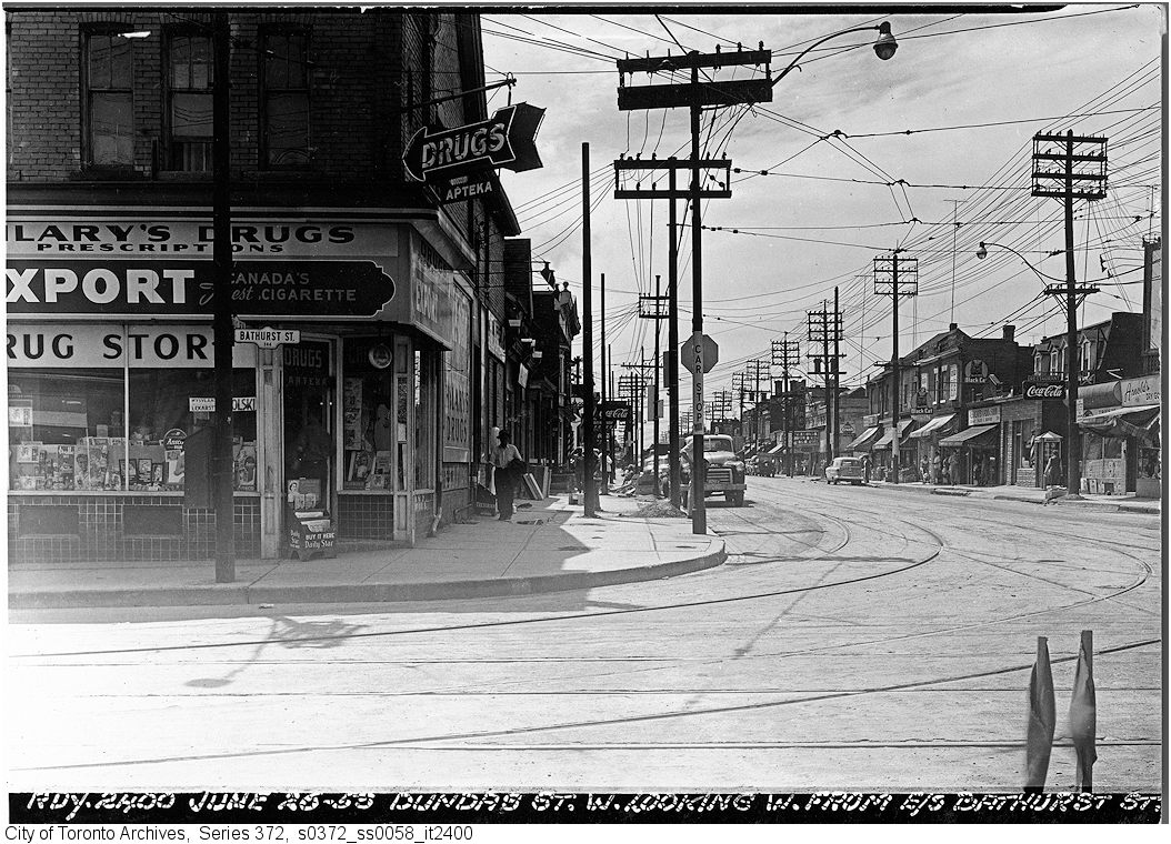
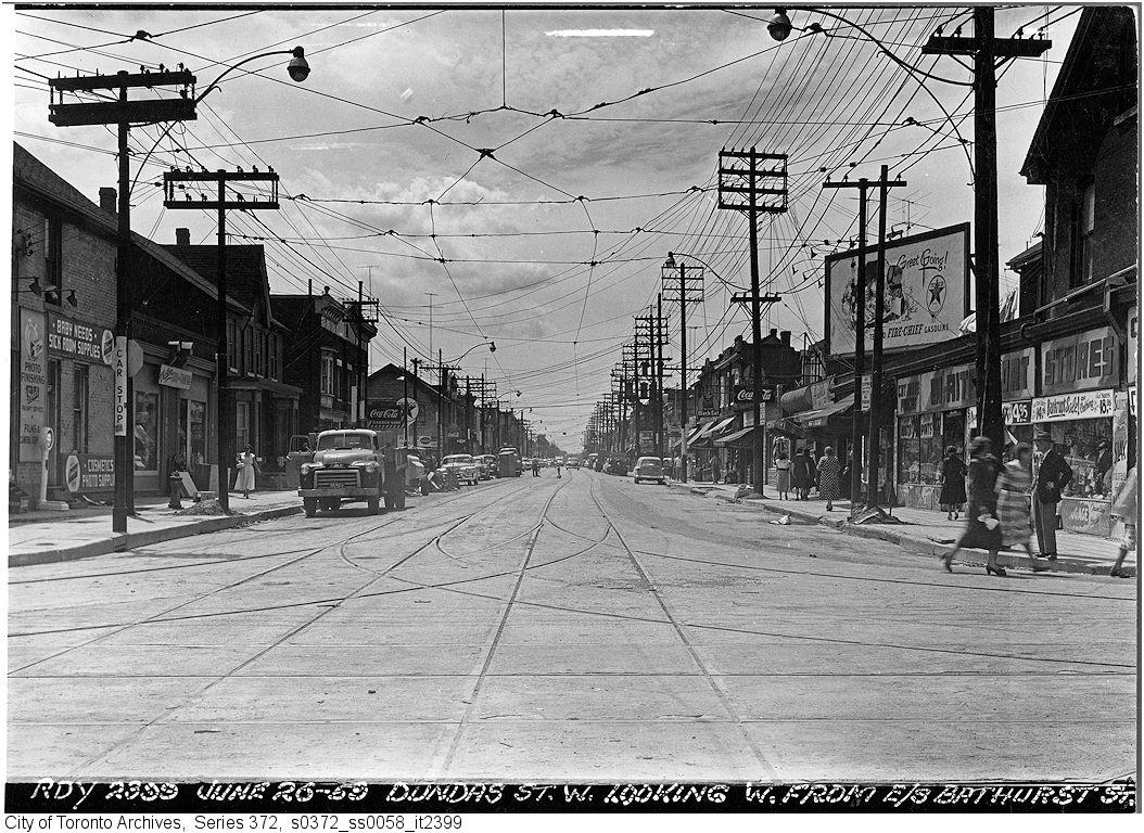
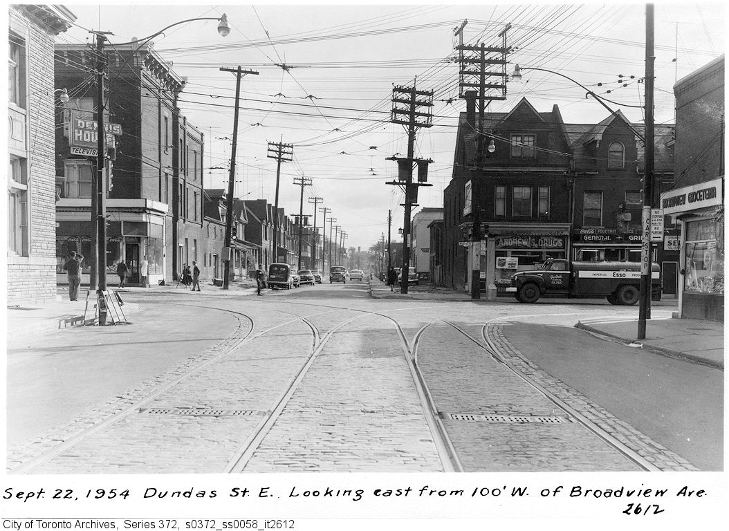
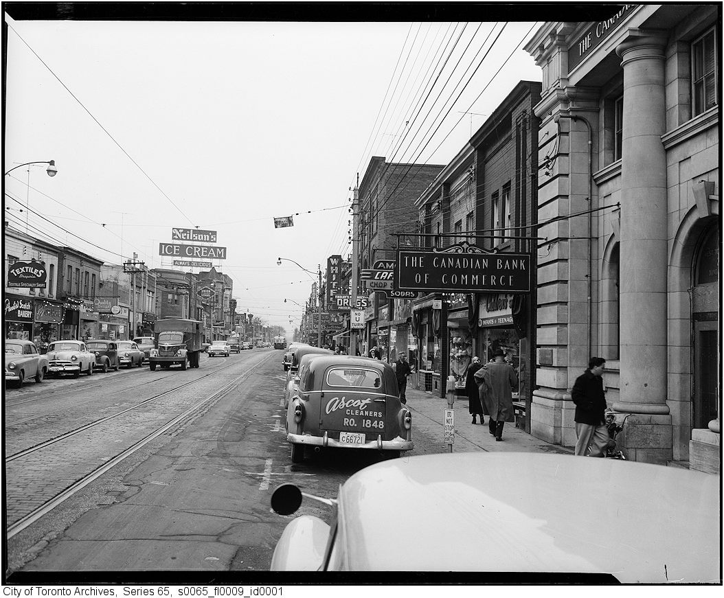
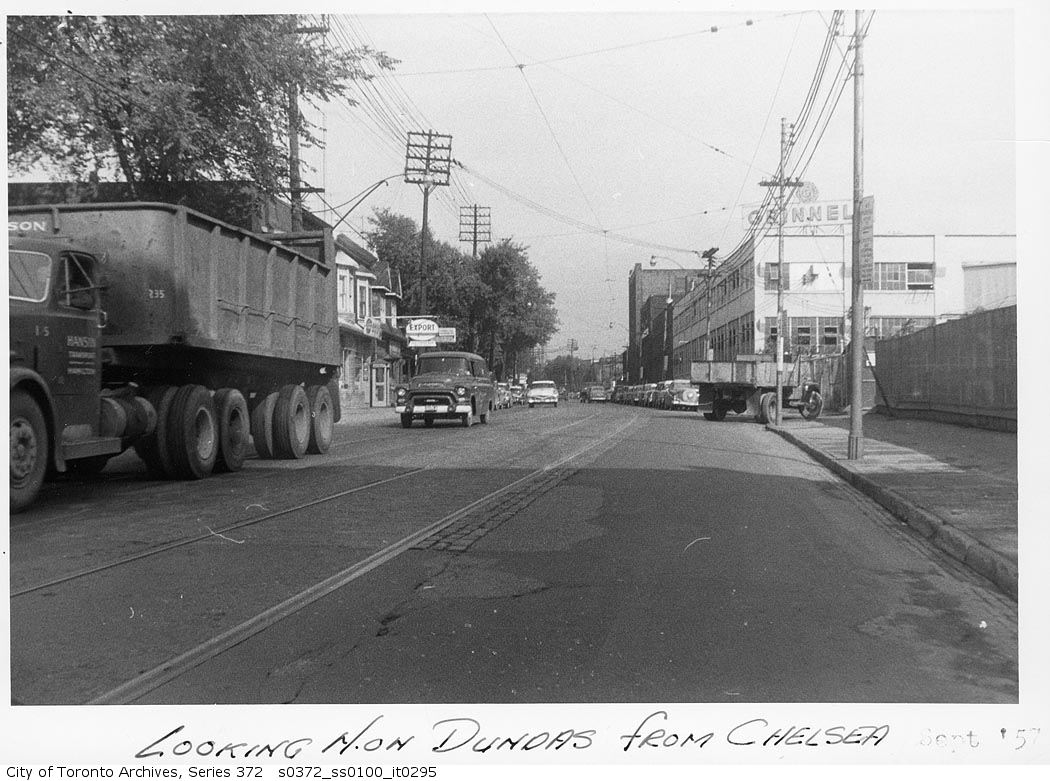
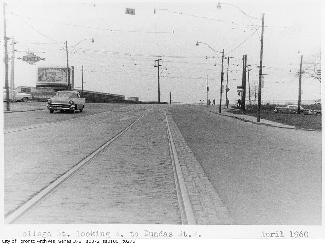
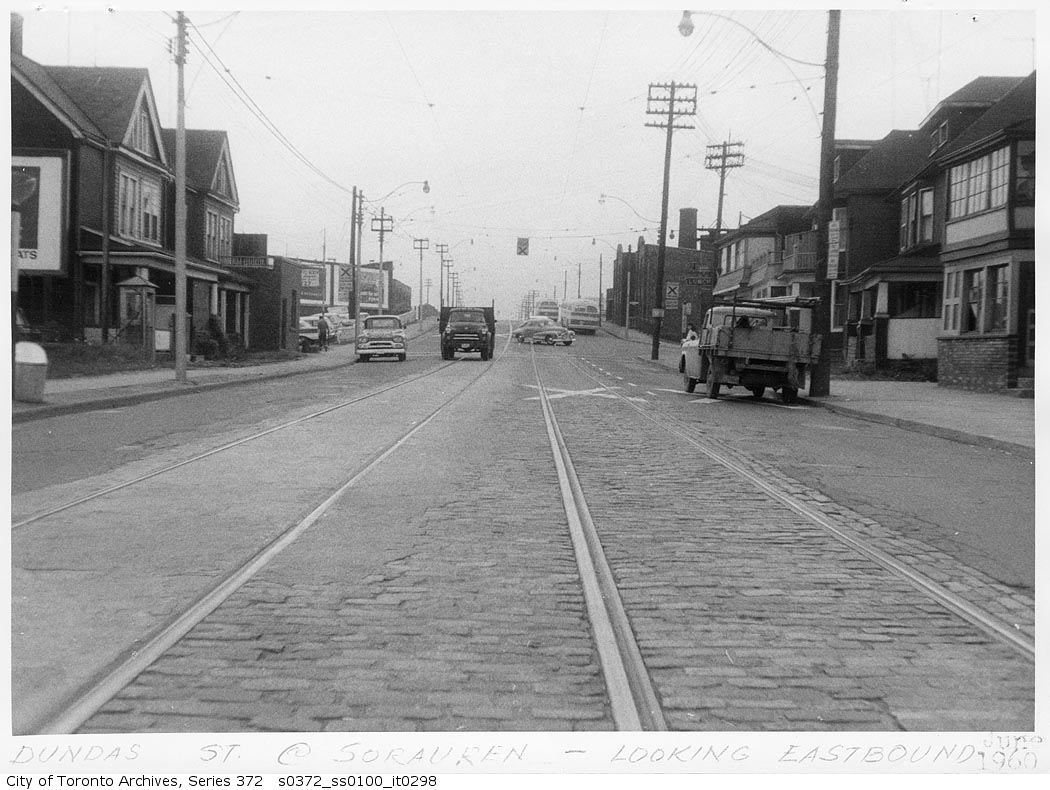
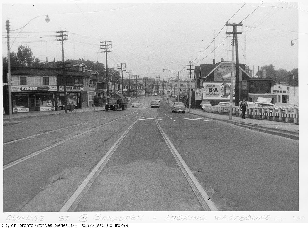
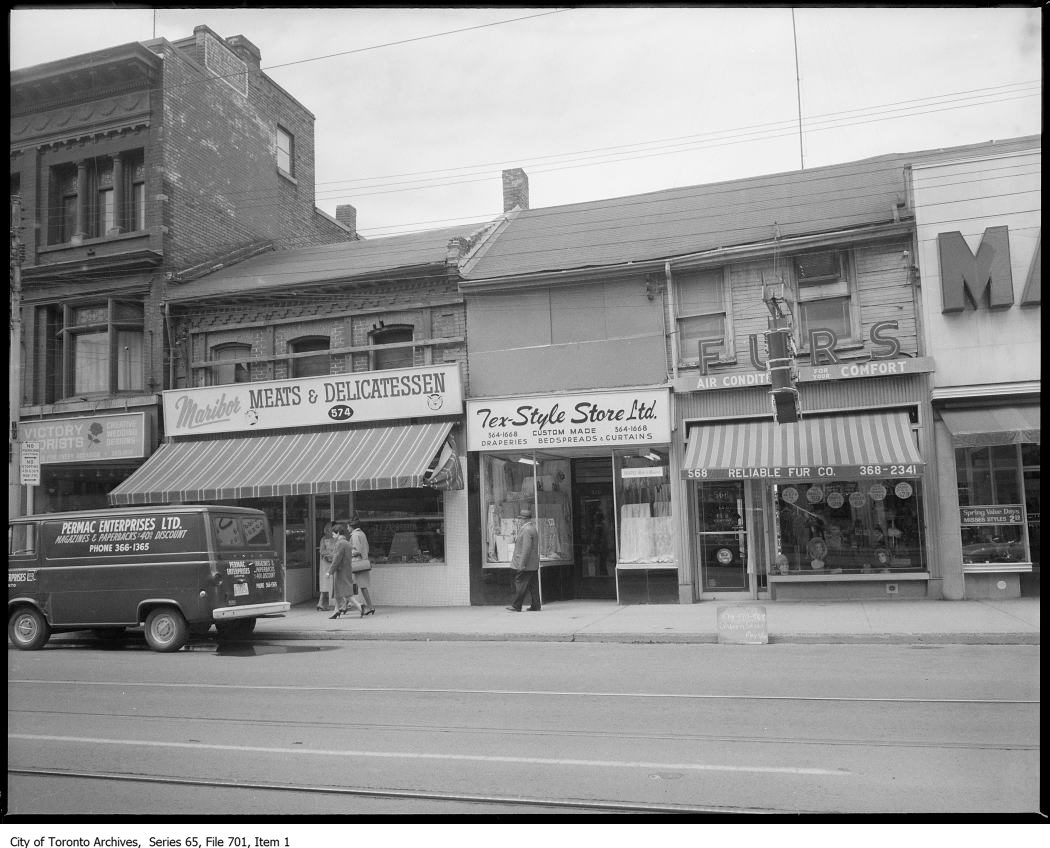
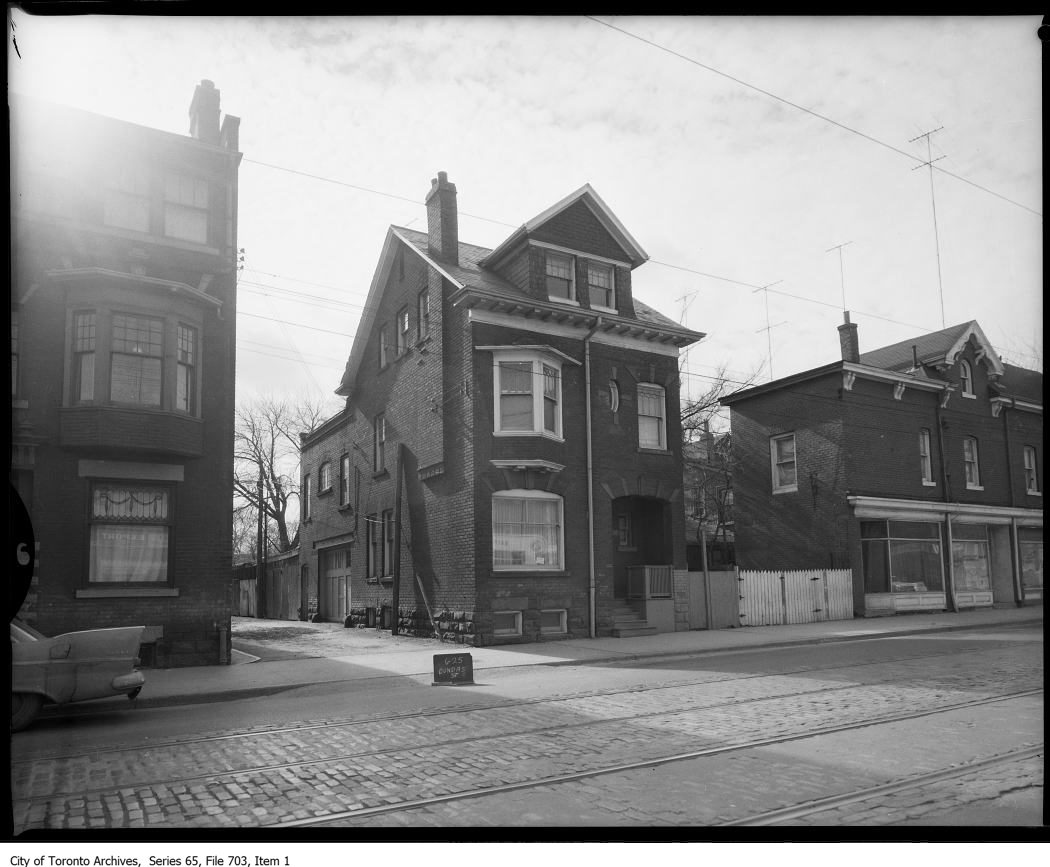
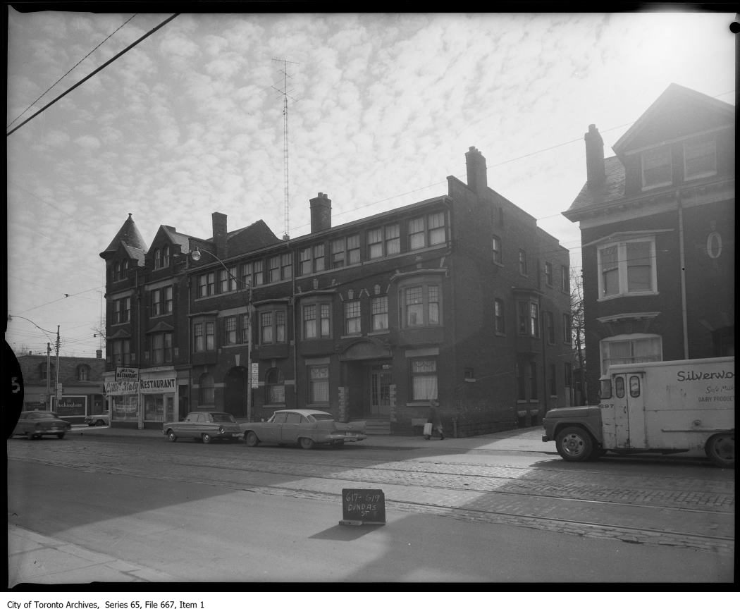
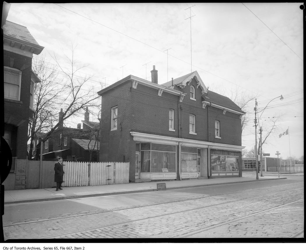
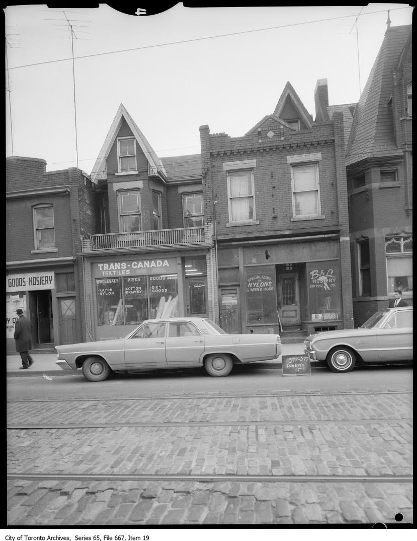
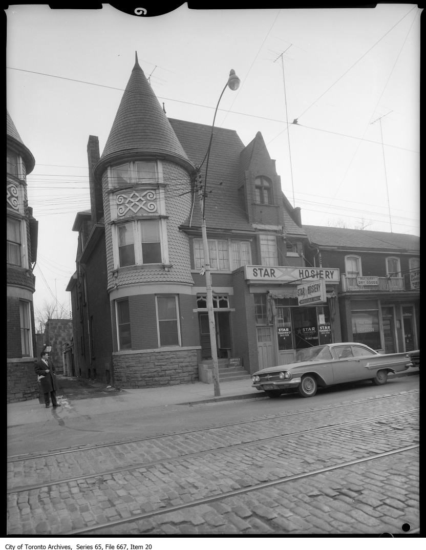
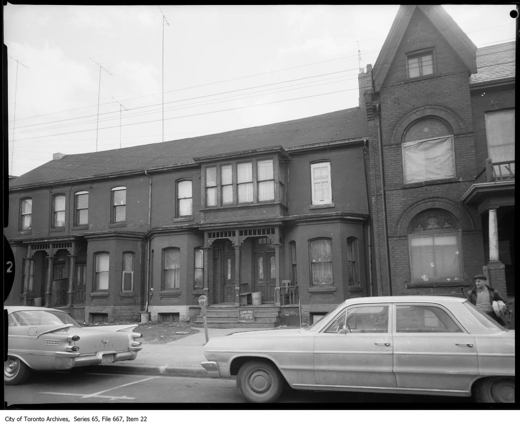
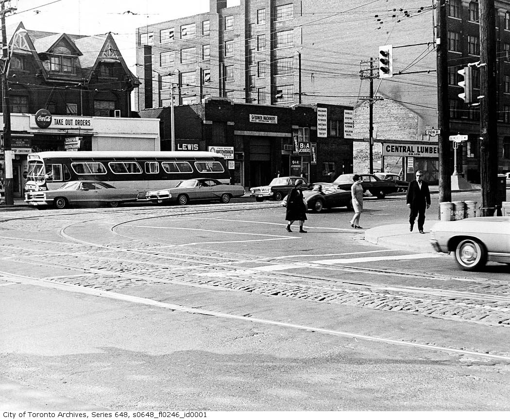
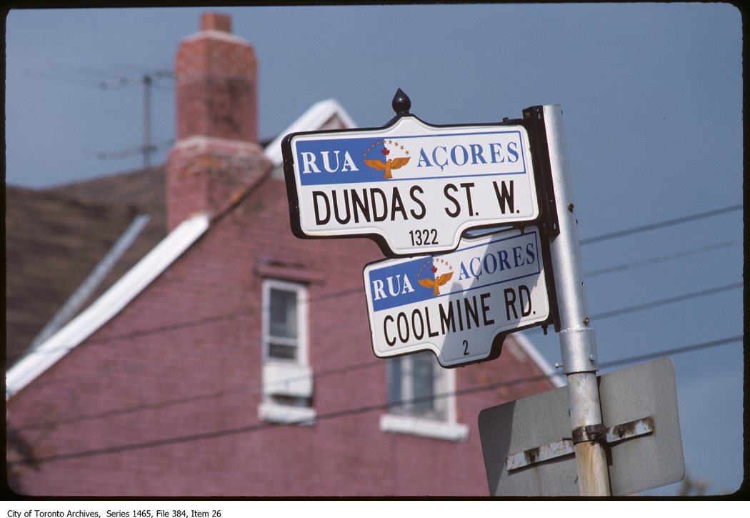
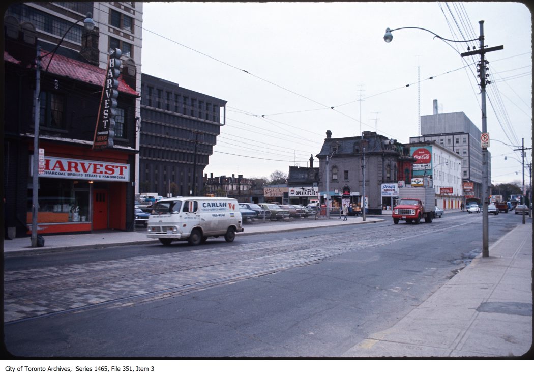
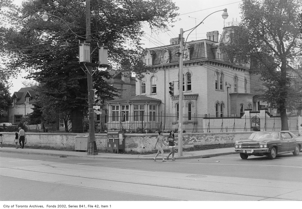
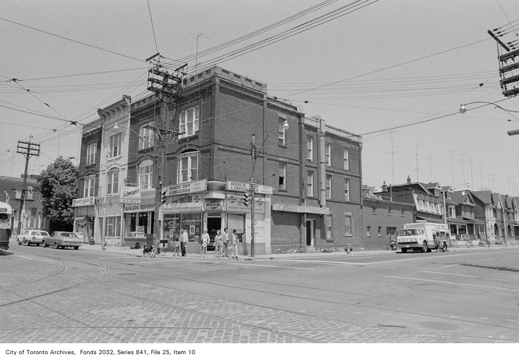
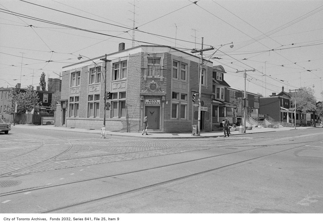
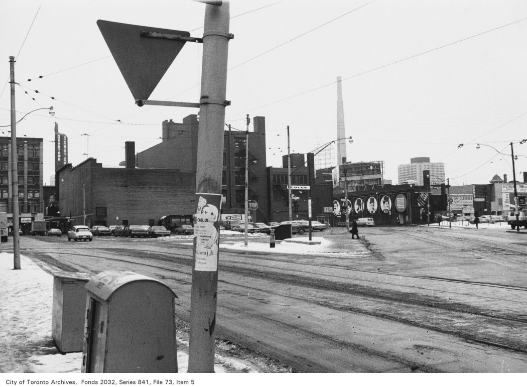
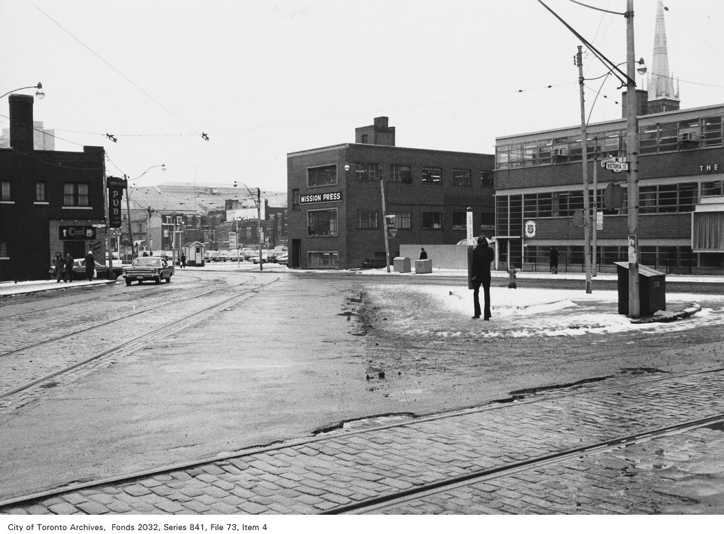
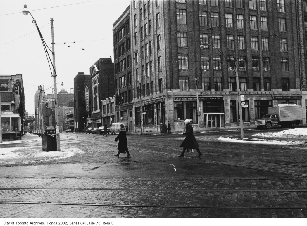
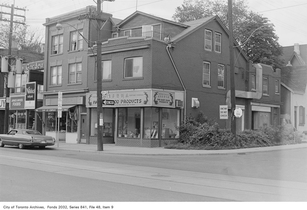
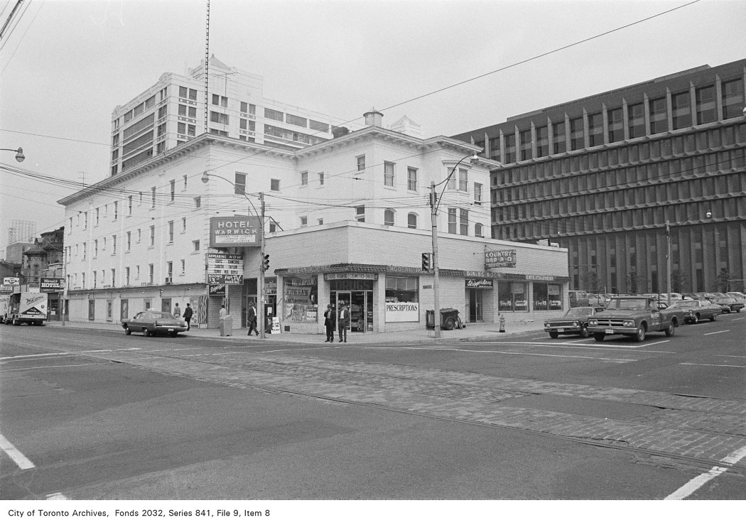
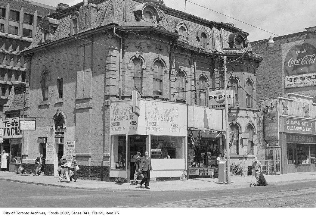
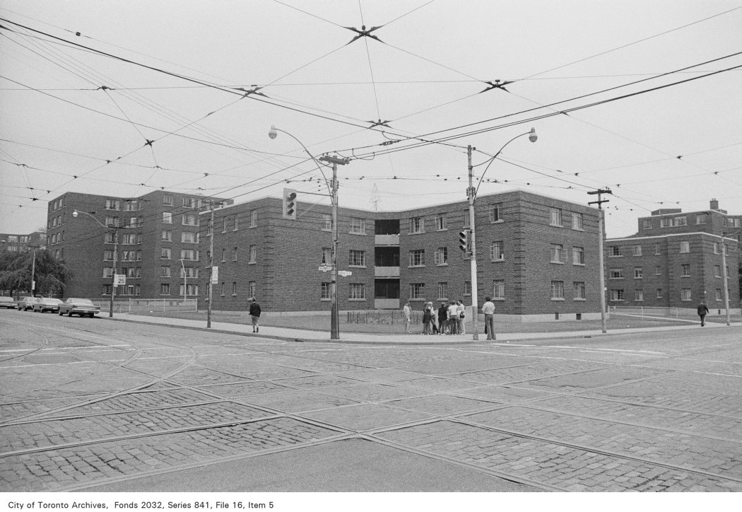
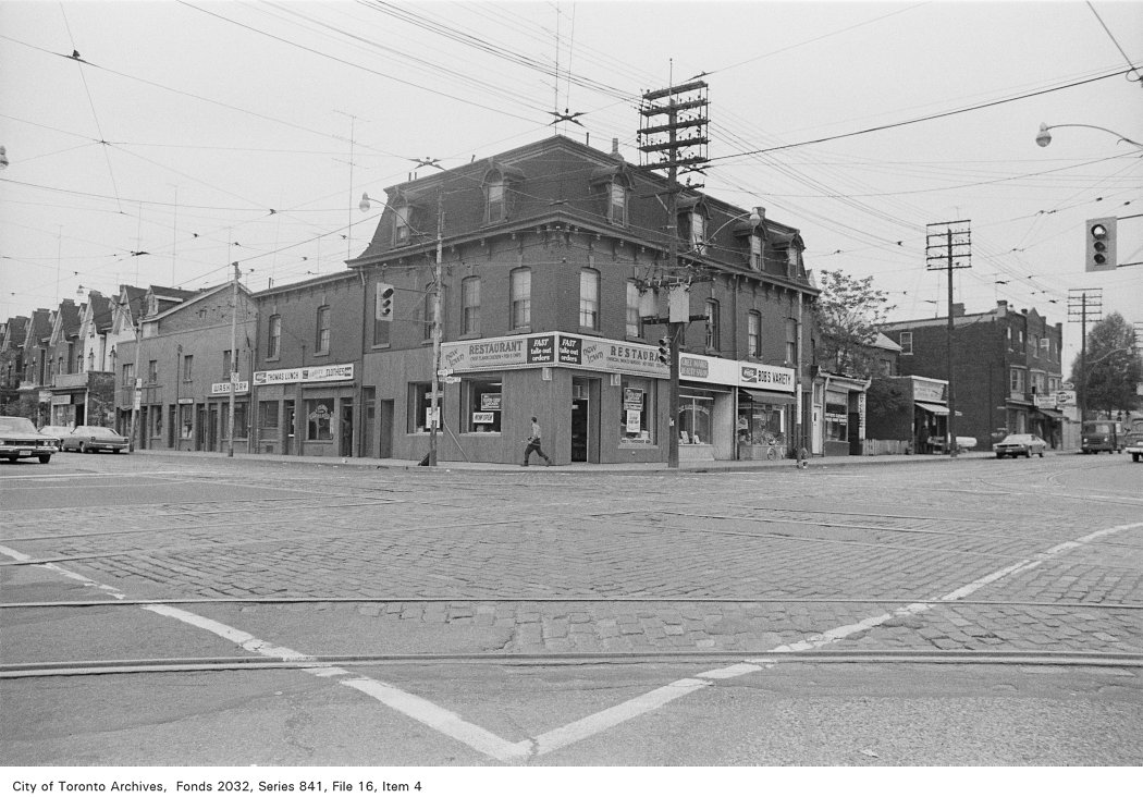
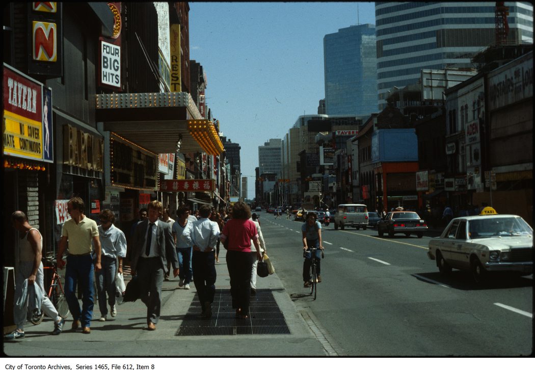
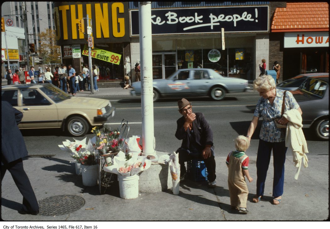
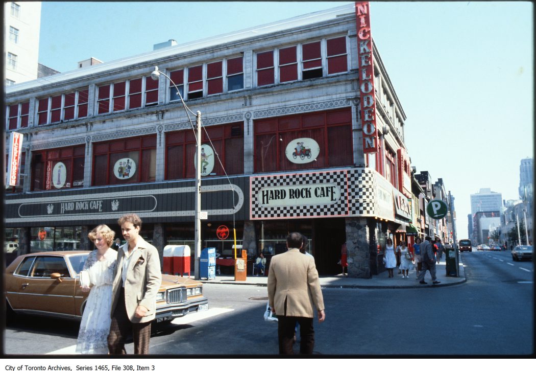
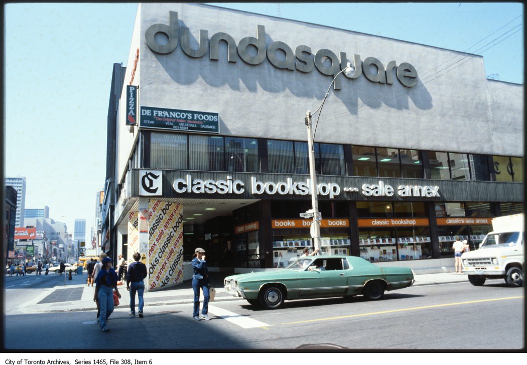
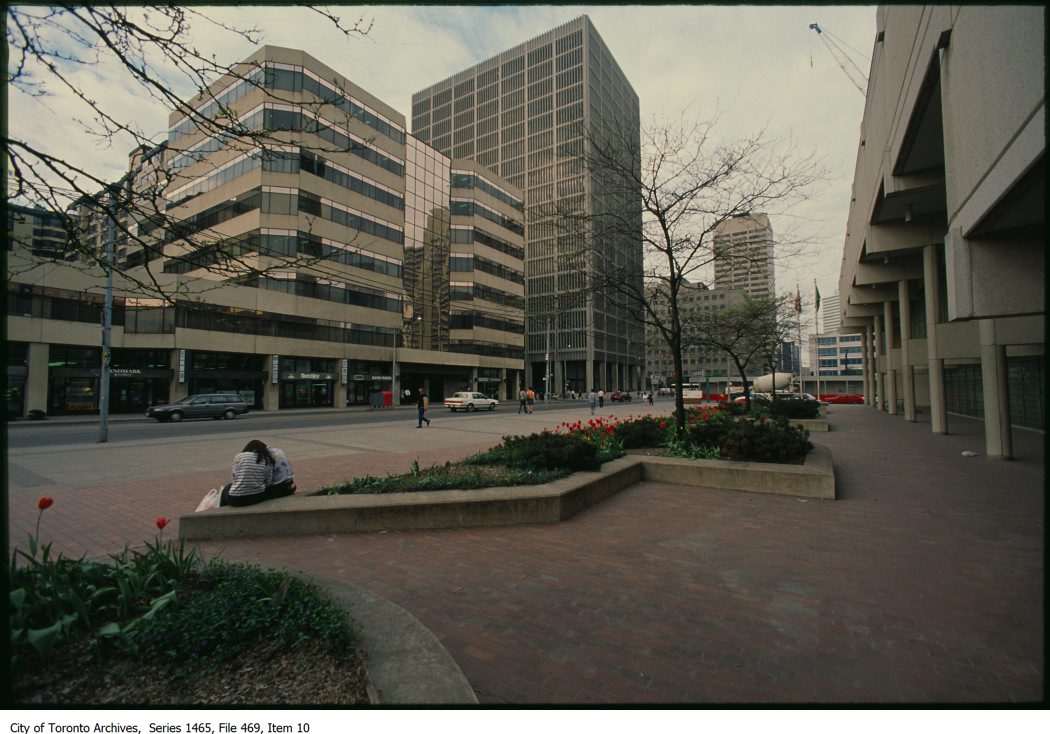
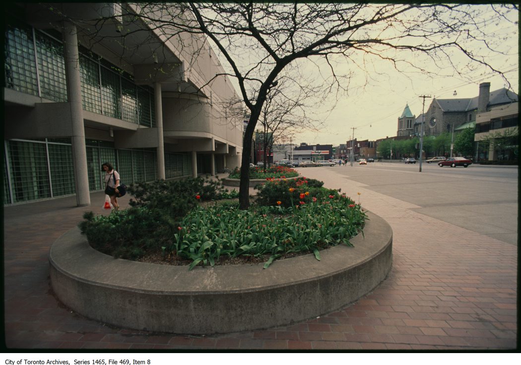
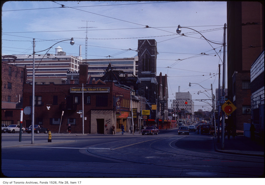
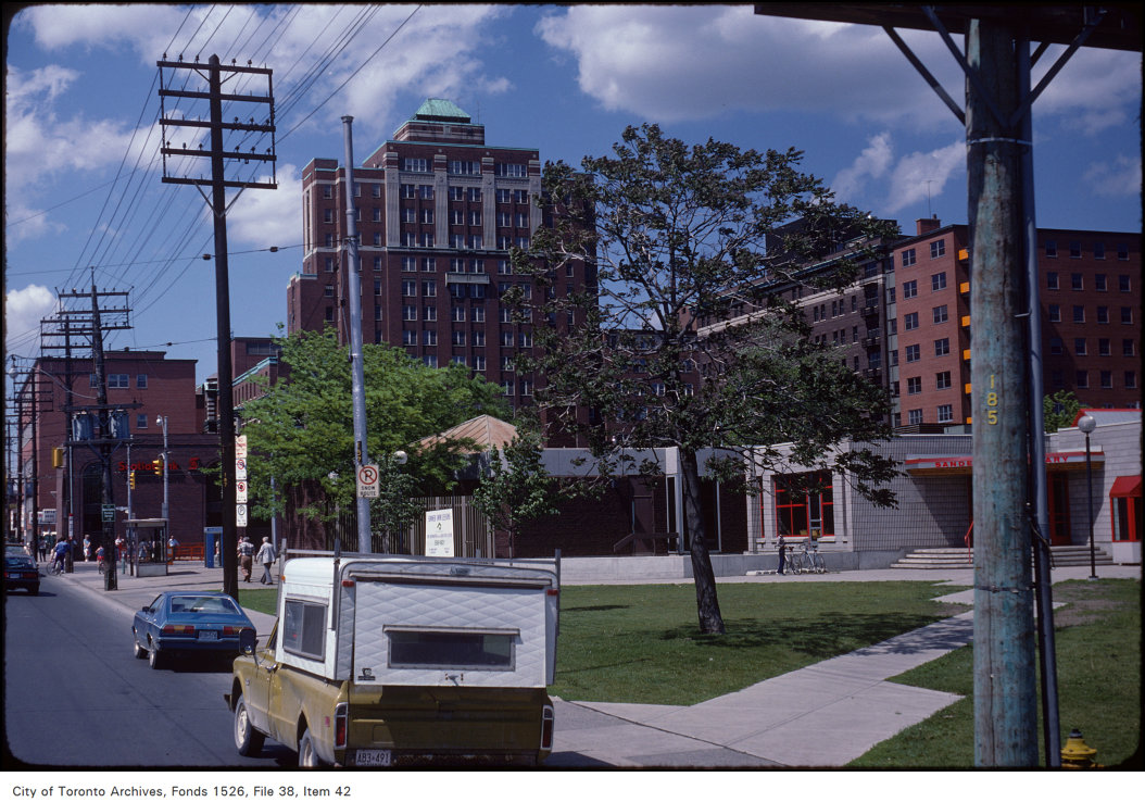
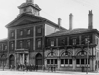
1907 – Lansdowne Avenue, west side south of Dundas Street1908 – Colonel George T. Dennison’s coaches, Dundas Street West1908 – Northeast corner of University Avenue and Dundas Street West1909? – Wooden walkway from Dundas Street to Art Gallery1910? – photograph taken of the north-east corner of Spadina Avenue and Dundas Street1911 – Church Street north at Wilton Street (Dundas Street) Track laying1912 – Dundas Street south of Humberside track allowance copy1912 – Dundas Street south of Humberside track allowance1912 – Dundas Street West at Royce Avenue (Peacock Hotel)1912 – Roncesvalles Avenue and Dundas Street looking north1912 – Runnymede crossing south to Dundas Street1914 – Dundas and Elizabeth streets1916 – Dundas Street west at Clendenan Avenue1917 – Dundas Street and Ossington Avenue – track allowance1917 – Dundas Street looking east to Ossington Avenue1917 – Dundas Street track reconstruction – Ossington Avenue to Lansdowne Avenue1919 – Bond Street and Dundas Street looking south1919 – Dundas Street west from Bond Street1919 – Dundas Street, looking east to St. Patrick Street1920 – 1926 – billboard located on the north side of Dundas Street East, east of Yonge Street. View is looking south-east.1920 – 1926 – photograph of a painted wall advertisement on the side of a building located at the north-west corner of Dundas Street West and St. Patrick Street.1920 – 1926 – photograph of two painted wall advertisements on the side of a building occupied by Joseph F. Crummey, Upholsterer, 377 Dundas Street East, at Ontario Street, south-east corner.1920 – Ossington Avenue looking south of Dundas Street1921 – Garage, Dundas Street1922 – 38 to 50 Dundas Street East1922 – Michaelson’s East End Bargain House, 310 Parliament Street, at Dundas Street East, lit with Humphrey gas arc lamps1922 – Old Country Furniture store, southwest corner of Dundas Street and Pacific Avenue1923 – 1615 Dundas Street West – oil tanks1923 – Canadian Electric Diners Limited1927 – Corner of Bloor Street West and Dundas Street West1928 – Northeast corner Dundas and Bay streets – Bay Street widening1928 – Southwest corner of Pacific Avenue and Dundas Street1929 – 1930 – photograph of a rooftop billboard location, Yonge Street, at Dundas Sttreet East, south-east corner. View is looking south-east.1929 – Centre Avenue and Dundas Street1929 – Traffic stopped for passing steam locomotive at level crossing1930 – “Telegram” paper box at 59 Dundas Street East1930 – 1935 – photograph of signage at a service station, Dundas Street East, east of Jarvis Street.1930 – 1935 – photograph of two rooftop billboards atop a building located at the south-west corner of Bay Street and Dundas Street West.1930 – Red Indian station, Beauford Road and Dundas Street1930 – Southeast corner Dundas Street and Brock Avenue1934 – 786 Dundas Street West1935 – Apollo Theatre1935 – Dundas Street, south side, east, at Parkway1937 – 1939 – photograph of a rooftop electric sign. View is looking east along Dundas Street West towards Yonge Street.1937 – 1939 – photograph of storefront signage, 2871-2873 Dundas Street West.1937 – Dundas Street East, looking east, past River Street1939 – 1778-1780 Dundas Street West — College Street Extension1940 – Southeast corner Dundas Street and University Avenue1950 – Firehall No. 7 and police station at 468-470 Dundas Street East1951 – Dundas and Dufferin street – intersection looking east1953 – Dundas Street West, looking west from Bathurst Street copy1953 – Dundas Street West, looking west from Bathurst Street1954 – Dundas Street East looking east from 100′ west of Broadview Avenue1954 – Dundas Street West1957 – Dundas Street West, looking north from Chelsea1960 – College Street looking west to Dundas Street1960 – Dundas Street West, looking east from Sorauren1960 – Dundas Street West, looking west from Sorauren1960? – 568-574 Dundas Street1960? – 625 Dundas Street1966 – Alexandra Park- Dundas Street-11966 – Alexandra Park- Dundas Street-11966 – Alexandra Park- Dundas Street-11966 – Alexandra Park- Dundas Street-11966 – Alexandra Park- Dundas Street-11966 – Alexandra Park- Dundas Street-11966 – Alexandra Park- Dundas Street-11966 – Alexandra Park- Dundas Street-11966 – Alexandra Park- Dundas Street-11968 – Spadina Avenue and Dundas Street West intersection-11968 – Spadina Avenue and Dundas Street West intersection-11968 – Spadina Avenue and Dundas Street West intersection-11968 – Spadina Avenue and Dundas Street West intersection-11968 – Spadina Avenue and Dundas Street West intersection-11968 – Spadina Avenue and Dundas Street West intersection-11970-1972 – Yonge Street and Dundas Street, looking east1970-1988 – Street signs at Dundas and Coolmine1972 – 1986 – Houses at 388 to 406 Dundas Street East1972 – 1987 – Dundas Street, looking north-east to Mutual Street1972 – Corner of Beverley Street and Dundas Street, looking north-west1972 – Corner of Broadview Avenue and Dundas Street, looking north-east1972 – Corner of Broadview Avenue and Dundas Street, looking north-west1972 – Corner of Broadview Avenue and Dundas Street, looking south-east1972 – Corner of Church Street and Dundas Street, looking south-east1972 – Corner of Dalhousie Street and Dundas Street, looking north-east1972 – Corner of Dalhousie Street and Dundas Street, looking north-west1972 – Corner of Dundas Street and Larch Street, looking south-east1972 – Corner of Dundas Street and Victoria Street, looking north-west1972 – Corner of Dundas Street and Victoria Street, looking south-east1972 – Corner of Dundas Street and Victoria Street, looking south-west1972 – Corner of Huron Street and Dundas Street, looking north-west1972 – Corner of Jarvis Street and Dundas Street, looking north-west, showing the Hotel Warwick1972 – Corner of Mutual Street and Dundas Street, looking north-east1972 – Corner of Parliament Street and Dundas Street, looking north-east1972 – Corner of Parliament Street and Dundas Street, looking north-west1972 – Corner of Parliament Street and Dundas Street, looking south-west1972 – Corner of Pembroke Street and Dundas Street, looking south-west1972 – Corner of Sherbourne Street and Dundas Street, looking north-west1972 – Corner of Sherbourne Street and Dundas Street, looking south-east1972 – Corner of Spadina Avenue and Dundas Street, looking north-east1972 – Corner of Spadina Avenue and Dundas Street, looking south-east1972 – Corner of University Avenue and Dundas Street, looking north1974 – Ford Hotel – under demolition – view west on Dundas Street at Yonge Street1977 – 1983 – Yonge Street, looking south to Dundas Street1977-1982 – Street vendor on Yonge Street at Dundas Street1978 – 1980 – Yonge Street, looking south from Dundas Square1978-1980 – Yonge Street, looking north from Dundas Square1980-1989 – Streetcar loading at Dundas Street, looking east from Yonge Street1980? – Annette Street and Dundas Street West1980? – Dundas Street West, looking east to University Avenue1980? – Dundas Street West, looking south-east to University Avenue1980? – Toronto Police Services 52 Division on Dundas Street looking east from St. Patrick Street1980? – Toronto Police Services 52 Division on Dundas Street looking east from St. Patrick Street1981 – Bond Street Temple – northeast corner at Dundas Street1981 – Toronto Western Hospital – view on Bathurst Street, near Dundas Street