Think rooftopping is a new fad? I found these old photographs on the Toronto Archives that show that it was around over 100 years ago.
If you do not know what rooftopping is, it is the act of taking photographs from the tops of skyscrapers and buildings to capture cityscape and aerial photography, usually done illegally. Many Instagram users in Toronto have become known for these death-defying and breathtaking images that capture the beauty of a city from the sky.
Aerial photography from planes has also become popular with many of these rooftoppers and Instagram users taking to personal flight tour companies such as iFly GTA.
Check out these photos of people shooting from roofs and share them with your friends.
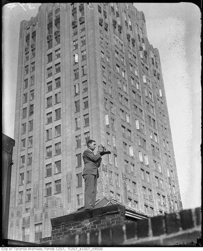
Rooftopping from the Royal Bank or CPR building – Intersection of King and Yonge streets. – [ca. 1930]Nat Turofsky Rooftopping with camera (ca. 1930)
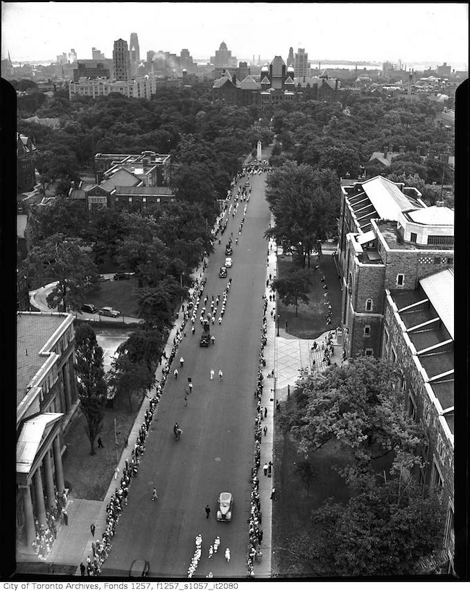
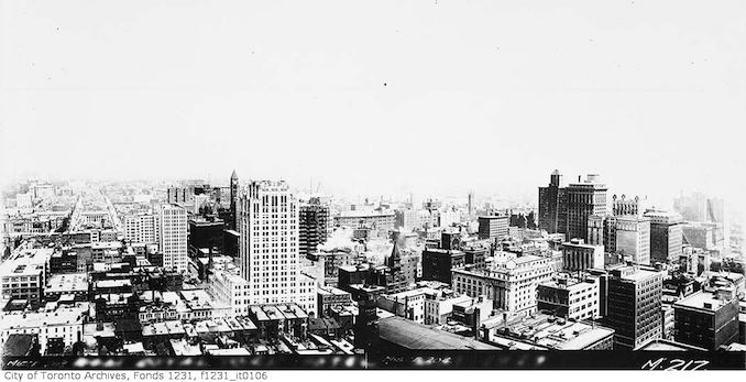
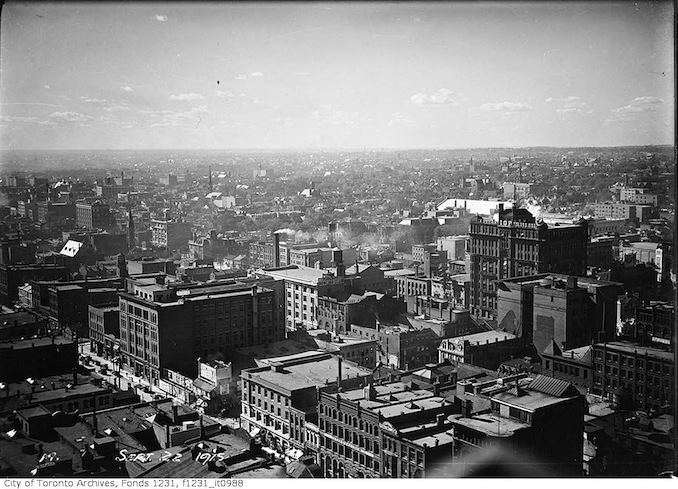
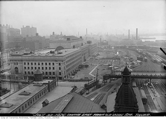
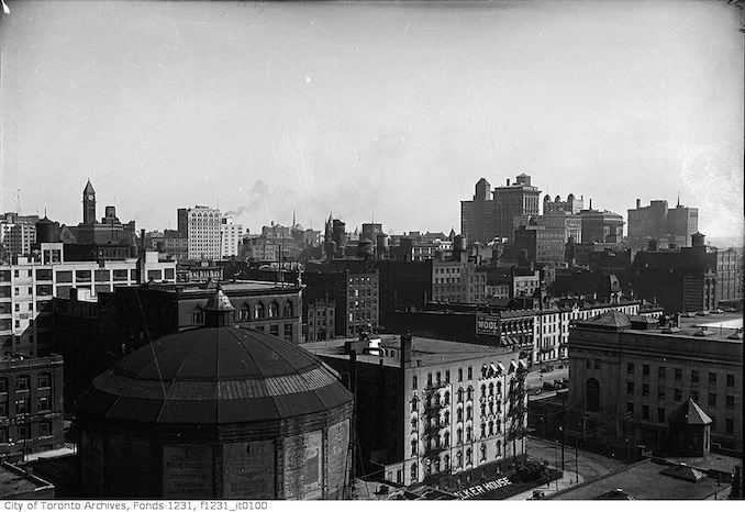
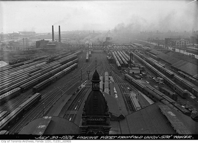
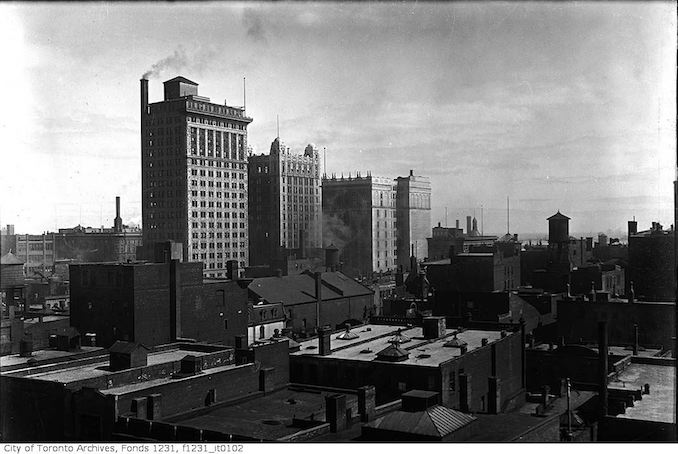
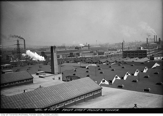
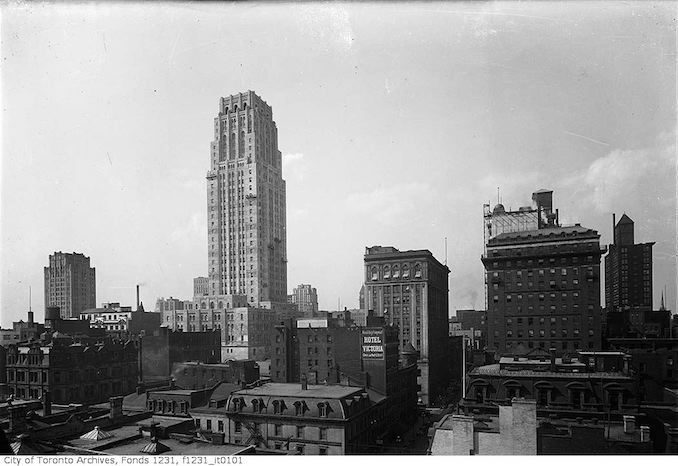
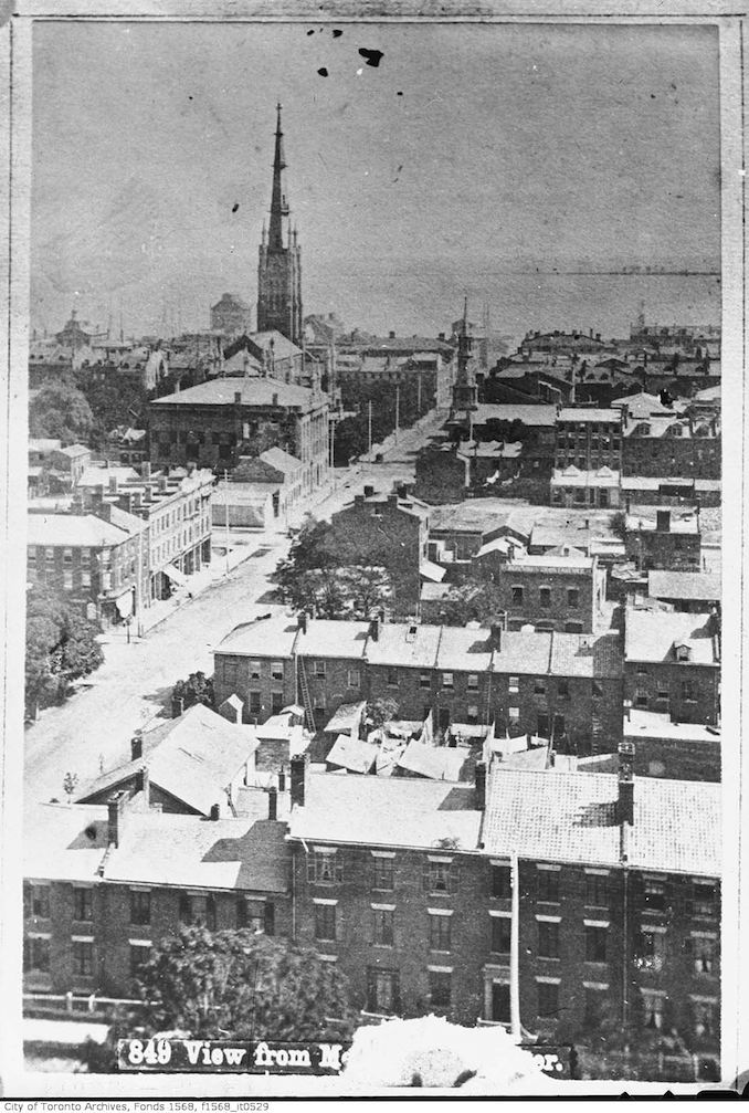
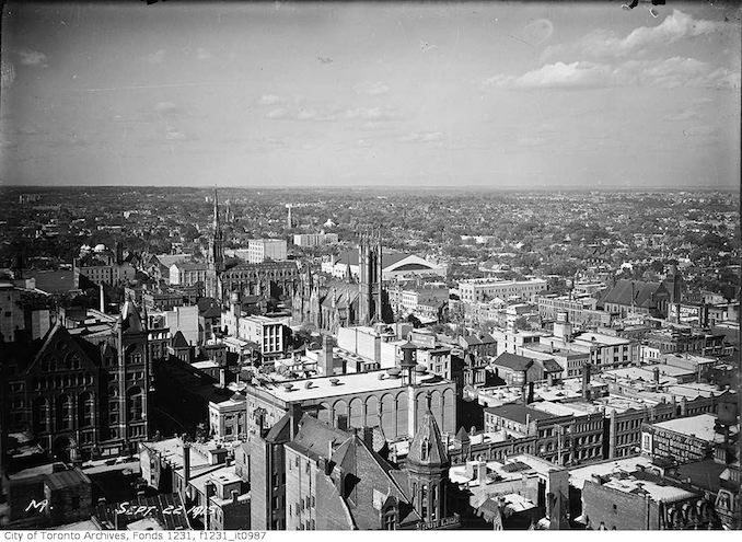
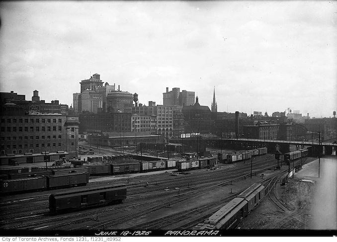
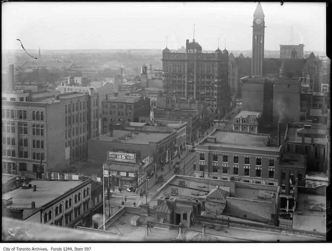
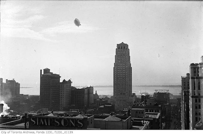
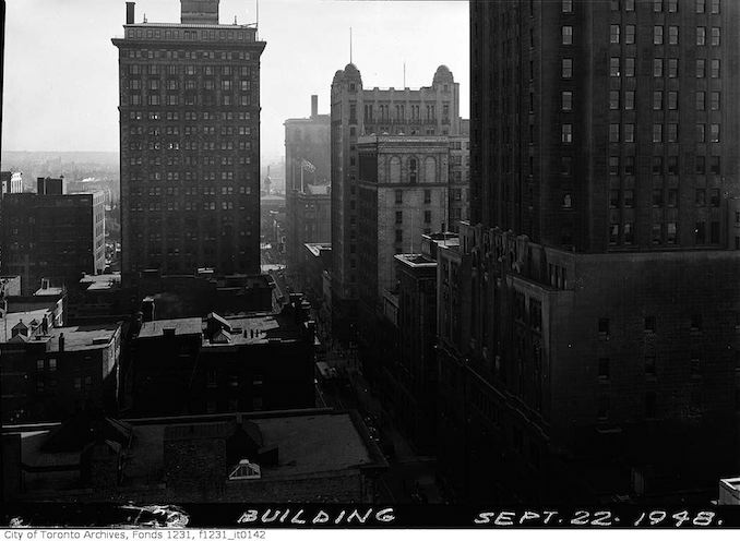
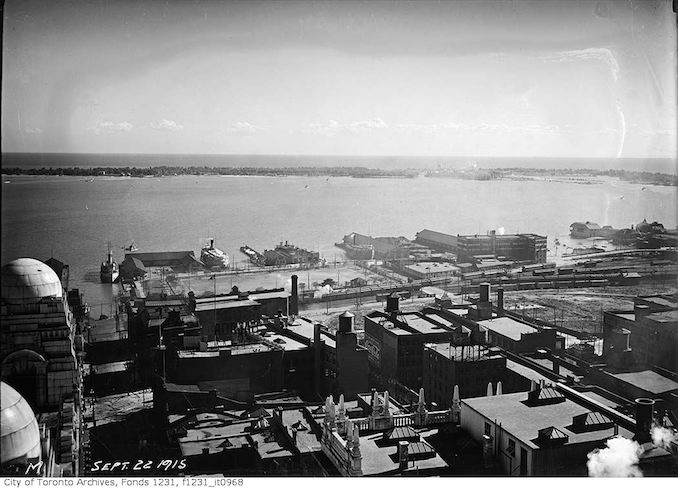
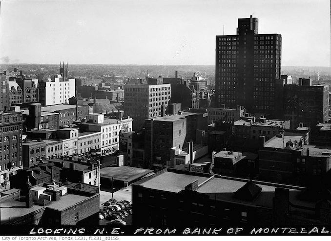
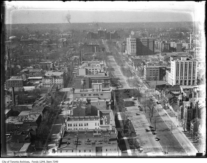
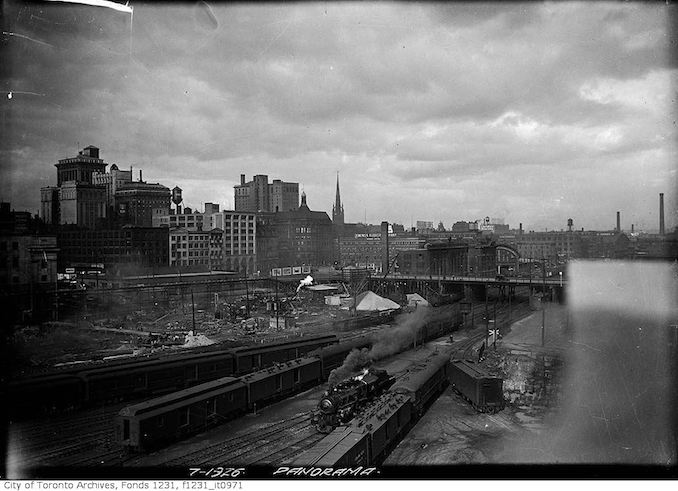
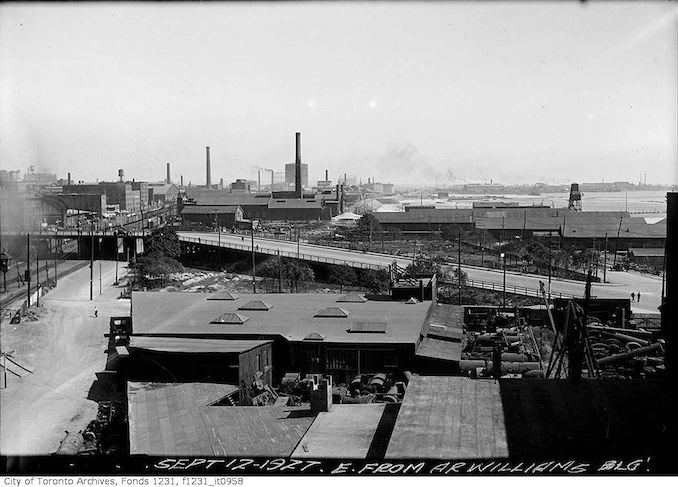
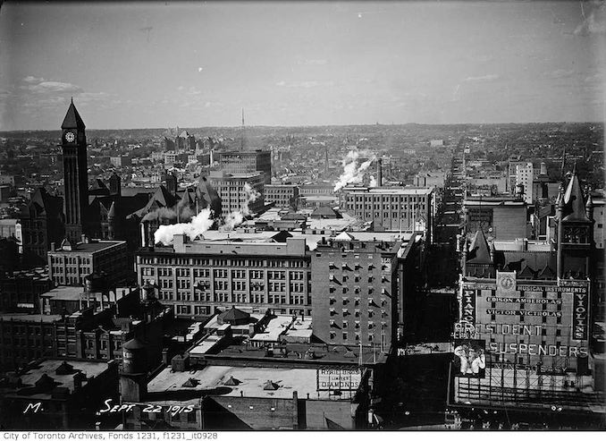
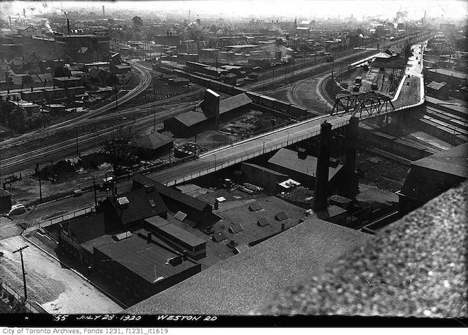
Rooftopping looking east from old Union Station Tower [ca. 1926]Aerial view northeast from Old Union Station Tower [1926]Aerial view of Toronto from old Union Station Tower to the west [1926]Aerial view of Toronto from the Continental Life Building [ca. May 6, 1919]Aerial view of Yonge Street, showing decking [ca. 1949]Canada Life Building, skyscraper view from 16th floor. [ca.1930]Canada Life Building, Bank of Commerce from 16th floor. [ca. July 5, 1930]Canada Life Building, Royal York Hotel from 16th floor. [ca. July 5, 1930]Canada Life Building, University Avenue from 16th floor, [ca. 1930]From east annex tower, C.N.E [ca. 1927]Looking north from the top of T. Eaton factory. – [ca. 1910]Looking northwest from the top of the Royal Bank building at King and Yonge streets. – [ca. 1914 -1916]Looking southeast from Richmond and Bay streets. – [ca. 1912-1920]Toronto aerial view north side from Board of Trade building [ca. 1930][ca. 1900] church street southAerial view northeast from Royal Bank Building [ca. 1915]Aerial view of Front and Church streets, looking southeast. – [ca. 1924]Aerial view of Toronto looking northeast from railway yards [ca. 1926]Bay Street at King Street looking north. – [ca. 1910]Dirigible R-100 visits Toronto [ca. 1930]Toronto – from top Royal Park – Yonge Street [ca. 1924]Toronto aerial view [ca. 1948]Waterfront from top of Royal Bank Building [ca. 1915]Toronto aerial view northeast from Bank of Montreal [ca. 1930-1950]University Avenue, looking north from roof of Canada Life Building. – [ca. 1929][ca. 1915]Aerial view looking east to Bay Street bridge [ca. 1926]Aerial view of Toronto east from A. R. Williams building [ca. 1927]Aerial view of Toronto looking north from Royal Bank Building [ca. 1915]Aerial view of Weston Road bridge district [ca. 1920]Canada Life Building – [ca. 1930]Canada Life Building, Toronto Armories from 16th floor – [ca. 1930]King Street East at Yonge Street, looking east. – [ca. 1910-1912]Aerial view of Orange Parade on University Avenue, looking south to Queen’s Park [ca. 1930-1950]Toronto aerial view north from Royal York Hotel [ca. 1929]Aerial view northwest from Royal Bank Building [ca. 1915]

![Rooftopping from the Royal Bank or CPR building - Intersection of King and Yonge streets. - [ca. 1930]](https://torontoguardian.com/wp-content/uploads/2016/02/finals-copy4.jpg)
![Aerial view of Yonge Street, showing decking [ca. 1949]](https://torontoguardian.com/wp-content/uploads/2016/02/Aerial-view-of-Yonge-Street-showing-decking.jpg)
![Canada Life Building, skyscraper view from 16th floor. [ca.1930]](https://torontoguardian.com/wp-content/uploads/2016/02/anada-Life-Building-skyscraper-view-from-16th-floor-1930.jpg)
![Canada Life Building, Bank of Commerce from 16th floor. [ca. July 5, 1930]](https://torontoguardian.com/wp-content/uploads/2016/02/Canada-Life-Building-Bank-of-Commerce-from-16th-flo-1930.jpg)
![Canada Life Building, Royal York Hotel from 16th floor. [ca. July 5, 1930]](https://torontoguardian.com/wp-content/uploads/2016/02/Canada-Life-Building-Royal-York-Hotel-from-16th-floor-1930-2.jpg)
![Canada Life Building, University Avenue from 16th floor, [ca. 1930]](https://torontoguardian.com/wp-content/uploads/2016/02/Canada-Life-Building-University-Avenue-from-16th-floor-horizontal-1930.jpg)
![Looking north from the top of T. Eaton factory. - [ca. 1910]](https://torontoguardian.com/wp-content/uploads/2016/02/Looking-north-from-the-top-of-T.-Eaton-factory-1910.jpg)
![Looking northwest from the top of the Royal Bank building at King and Yonge streets. - [between 1914 and 1916?]](https://torontoguardian.com/wp-content/uploads/2016/02/Looking-northwest-from-the-top-of-the-Royal-Bank-building-at-King-and-Yonge-streets-1914-1916.jpg)
![Looking southeast from Richmond and Bay streets. - [between 1912 and 1920]](https://torontoguardian.com/wp-content/uploads/2016/02/Looking-southeast-from-Richmond-and-Bay-streets-1912-1920.jpg)
![Aerial view of Front and Church streets, looking southeast. - [1924]](https://torontoguardian.com/wp-content/uploads/2016/02/Aerial-view-of-Front-and-Church-streets-looking-southeast-1924.jpg)
![Toronto - from top Royal Park - Yonge Street [ca. 1924]](https://torontoguardian.com/wp-content/uploads/2016/02/Toronto-from-top-Royal-Park-Yonge-Street-1924.jpg)

![Canada Life Building - [ca. 1930]](https://torontoguardian.com/wp-content/uploads/2016/02/Canada-Life-Building-skyscraper-view-from-16th-floor-1930.jpg)
![King Street East at Yonge Street, looking east. - [ca. 1910-1912]](https://torontoguardian.com/wp-content/uploads/2016/02/King-Street-East-at-Yonge-Street-looking-east-1910-1912.jpg)